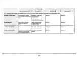
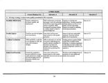
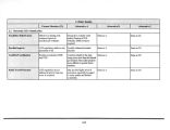
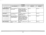
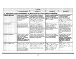
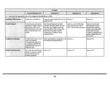
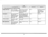
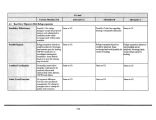
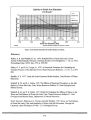
| OCR Text |
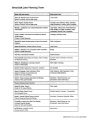
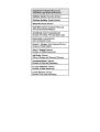
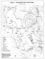
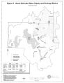
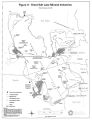
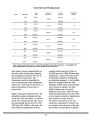
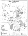
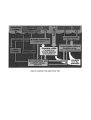
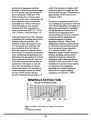
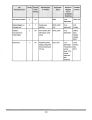
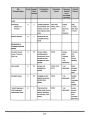
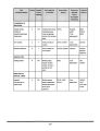
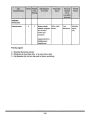
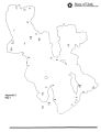
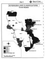
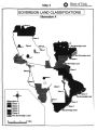
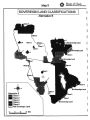
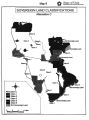
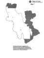
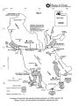
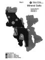
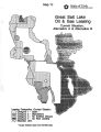
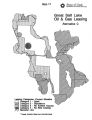
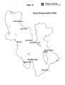
Show Map Index List of Maps Map 1 Water Rights Regions Map 2 Water Rights Administrative Areas Map 3 Sovereign Land Classifications: Current Situation Map 4 Sovereign land Classifications: Alternative A Map 5 Sovereign Land Classifications: Alternative B Map 6 Sovereign Land Classifications: Alternative C Map 7 Sovereign Lands 39 Townships Identified by the Legislature for Wildlife Management Map 8 Mineral Extraction Industries, the SPRR causeway, the Behrens Trench, and Brine Density Measurement Sites - Great Salt Lake, Utah Map 9 Mineral Salts: Current Situation, Alternative A and Alternative C Map 10 Oil and Gas Leasing: Current Situation, Alternative A and Alternative B Map 11 Oil and Gas Leasing: Alternative C Map 12 Brine Shrimp Harbor Sites 359 |