| Identifier |
/tanner/image/forty_niner.xml |
| Title |
A Forty-niner in Utah with the Stansbury Exploration of Great Salt Lake: Letters and Jounral of John Hudson, 1848-50 |
| Creator |
Hudson, John, 1826-1850 |
| Subject |
Frontier and pioneer life; Letters; Diaries -- Authorship; Latter Day Saints |
| Subject Local |
Mormons --Utah--Biography; Frontier and pioneer life --Utah; West (U.S.) --Description and travel; Utah --Description and travel |
| Description |
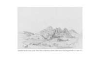
John Hudson, artist and writer, chronicles his travels from New York City across the Plains towards California to partake in the Gold Rush. What was to have been a temporary stop in Salt Lake City stretches to sixteen months and includes participation in Captain Howard Stansbury's expedition of the Great Salt Lake. |
| Publisher |
Tanner Trust Fund University of Utah Library, Salt Lake City, Utah |
| Contributors |
Madsen, Brigham D.; Cooley, Everett L.; Tyler, S. Lyman; Ward, Margery W. |
| Type |
Text |
| Format |
application/pdf |
| Language |
eng |
| Relation |
Is part of: Utah, the Mormons, and the West, no. 11 |
| Coverage |
Time: 1848-50 |
| Rights Management |
University of Utah, Copyright 2001 |
| Holding Institution |
J. Willard Marriott Library, University of Utah |
| Source Physical Dimensions |
14.75 cm x 23 cm |
| Source Characteristics |
Printed Hard Cover Book |
| Scanning Technician |
Karen Edge |
| ARK |
ark:/87278/s6v1242x |
| Topic |
Mormons; Frontier and pioneer life; United States, West; Utah; Letters; Diaries--Authorship |
| Setname |
uum_ttb |
| ID |
327931 |
| Reference URL |
https://collections.lib.utah.edu/ark:/87278/s6v1242x |


