| OCR Text |
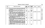
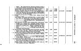
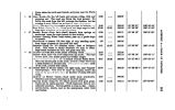
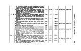
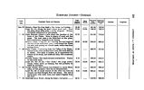
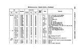
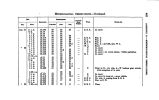
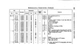
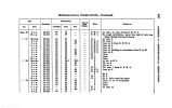
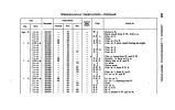
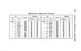
Show HOMBWABD JOURNEY- Continued. CO o w » o 8 s s DATI. 186a PEOMIHWT Ponra AHD RIM it KM. Intermediate Distance. Day^ i March. Total from Fort Laramie. Total from Salt Lake Citj. Latitude. Longitude. Oct 22 " 28 « « 24 « 26 " 26 SPBJHG- Near the river bank u ftuet Urge, oool spring..** CAMP No. 41- Along the level bottom, pood road. Hero the plain, three miles wide, Cvuld be irrigiited. Willows and small oottonwood on the islands. GAMP GROUND- About a mile above the junction of the forks of the Platte. Here is plenty of wood and fine grass. The road rises to the table- land at this plaoe, and occasionally descends to the bottom. SPRING CRKHK- tVtiup No> i'l- Leaving the road track at the foot of the table- land, pasa duwn toward the Platte outs mtte> aiul enoamp on IL nmtiU creek, which rises from springs above, FIRST CBHK- Continuing down the Valley of the Platte; islands in the rive* covered with trees, but wood difficult to obtain. The table is broken, as it approaches the bottom on the south, into bluffs and hills, with occasional cedars. FOURTH CHICK- Two small streams intermediate. Timber on the south bank. CAMP NO. 48- At the " Two Trees," two large cotton-woods, which serve as beacons, but will probably be felled by travellers. PLUMB C& EIK- The bottom has widened to about fifteen miles, is well grassed; fuel can be obtained here. CAMP NO. 44- A small branch of the river can here be crossed, and fuel brought from the island. The soil is marly sand, with some loam, and easily irrigated from the river. EIOHTIJSN- MILE POIHT- Along the bank; road good 18.40 17.94 11.70 28.68 11.20 6.16 18.94 80.62 8.82 16.41 81.84 86.28 86.28 84.84 181.86 199.80 211.00 284.68 246.78 260.98 269.87 800.89 804.21 819.62 747.20 766.14 776.84 800.42 811.62 816.77 886.71 866.23 870.06 886.46 |


