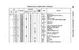
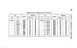
| OCR Text |
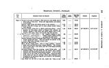
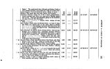
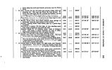
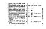
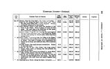
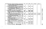
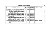
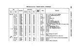
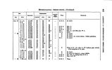
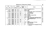
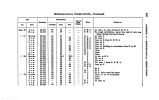
Show at the heads of ravines and spring- branches of Crow Greek. Pines, fir, cotton- wood, for timber; currants and hawthorn bushes, and low bush, black cherries. CAMP NO. 27- Down left bank; trees ended; willows for fuel; the creek sinks into the sand just below. The road from this point abouM strike eaemurdly, crc^ inf? several small branches, an J finally follow down Lodge I'olu Greek, to the South Fork of the Platte River. CROW BRANCH- Passing north, into the Ghejenne Pass, along the foot of the Black Hills on the west, and a table- land, two hundred feet above the level of the road, two miles to the right. LODGE POLB BRANCH- Supposed branch of Lodge Pole Creek; 8 feet wide; no fuel in the pass; but at the kanyon, abundant LODQI POLE CRBIK- About two miles below Kanyon Greek; 3 feet wide. NOON HALT- Bear Creek, a branch of Lodge Pole Creek; water in pools. HORSE CREEK- Supposed south branch H0R8B CREEK- Main branch; 4feet wide NORTH BRANCH- Haying crossed a marsh rivulet CHUGWAILU Kivhii- Camp No. 28- From the north branch, you soon pnsa over a low " divide," to a dry branch of Chug-water; thence* down this, to the Chujf gates, where there is plenty of bui- elder, willows. Ac. Hero the river breaks through a plateau that joins the table on the east side of the Cheyenne Pass. CH DO WATER RIVER- Pass down bank, crossing the creek at four and three- fourth miles; cross the main stream twice; fuel and pra^ y nlntndant: high land on on oh side of the stream. NOON HALT- Luttoni- hLnd oac- fuurth utile wide. Observation for latitude. CAMP No. 29- On the bottom- land, which is here half a mile wide. A reconnoissance made from this point, among the Black Hills, is not here inserted. | 8.72 8.43 6.77 8.00 2.14 4.01 1.20 1.67 8.99 4.76 9.68 8.98 1 14.66 80.28 17.71 471.28 474.66 480.48 483.44 486.68 489.60 490.79 492.46 601.46 606.20 616.88 619.16 41° 09' 08". 6 41° 21' 46". 7 41° 46' 86". 8 41° 89' 68". 4 106° 08' 24" 106° 12' 21" 104° 69* 26" 104° 66' 46" • a o 09 W Ott to 00 |


