| OCR Text |
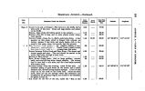
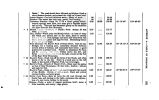
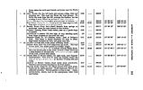
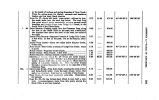
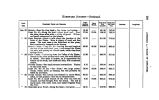
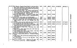
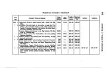
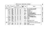
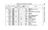
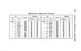
Show HOMEWARD JOURNEY-< Sept 12 " 18 « 14 " 16 PLAIN- Meridional obserratton %\ v$* the latitude. The route lies across the preat bend of Blacks Fork. BLACK'H FOUK- A getitie slope, for six miles, on the eastern side of the table land; no water at this season; road good; ford easy; creek 150 feet wide; buffalo- berry and currant-bushes for fuel. SUMMIT of ridge between Black's Fork and Green River- Road gnud, ami Hermit geutiu ; thence down Rabbit Hollow. GunfcN RJVKR- Right btknk; river 800 feet wide ; ford good at this stage of thu water; cross diagonally. The road descends into Rabbit Hollow, and winds along the dry channel of a creek in the bottom. CAMP NO, 12^- Followbp < Ir> wti left bank to near the outlet of Bitter Creek . fuel nMinilitot, BITTER CREEK COAL- BED- Strike Bitter Creek in one mile from Camp. There is coal on the left bank, under a high bluff, two miles from the mouth. EVAN A'* T HACK- Camp No. 13- This U a trace made by a party of emiprniita from Arkansas, in 1849, which continues north of Bitter Creek to Hridler's Port The grass on this part of the route is very limited, and enge the only fuel. Water slightly brackish and sulphurous. POND- Half a mile to the north- east is a small pond FORD- Cross to the left bank; Evans's Trace on the right; creek 80 feet wide, and 6 feet deep; banks steep. SULPHUR SPRINGS- Camp No. 14- Several beds of coal crop out in the bluffs along the creek, and are easily crumbled down for fuel. The springs are on the right bank, and issue from the base of high bluff rocks of gray sandstone. Evans's tied. Day's March. 25.44 18.87 17.08 24.86 Total from SaltLak* City. 169.90 171.91 179.86 188.81 186.28 198.87 202.31 212.91 218.88 227.17 Latitude 41° 81' 08". 8 41° 8< y44". 6 41° 84' 40". 8 Longitude. 110° 04' 16" 109° 88' 40" 109° 28' 09" to 00 to s H O |


