| OCR Text |
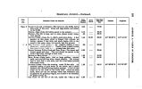
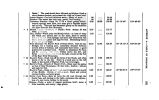
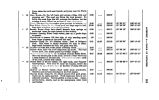
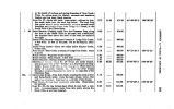
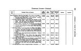
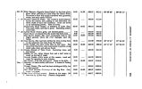
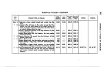
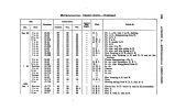
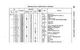
Show FORT KBARNT- Opposite Grand Island, in the level plain, about three quarters of a mile from the Platte River. The sutler's store will supply travellers with groceries, cloths, and many useful articles. PLATTE- Leave the Platte. The course is south- easterly, across the bottom, and, passing to the table- land, between bluffs of sand and sandstone. Cross the divide on an undulating prairie. Hills not steep. THIBTT- TWO MILE CREEK- A tributary of Little Blue. Very little water, and that in pools. Scattering ootton-wood trees. LITTLE BLUE- Cross a gully, and descend gently NOON HALT- A branch from the south- west here joins..... DRY SANDY CREEK- The road occasionally rises to the higher ground, where the river impinges upon the banks. OAK GROVE- The road here strikes the river, having been on the upland for ten miles from Dry Sandy. TURN CREEK- We leave Little Blue at this place. The route from Oak Grove often interrupted by gullies, along which oaks, elms, and ash are found. CREKK- Branch of Turn Creek. Scattering trees, and good grass. CREEK- At two miles, thence four and a half miles to wood, on dry bed of creek. OX- BOW CREEK- Little water at this season; wood and water for camping in early summer. BIO SANDY- Fuel and water good. Grass on the hills BRANCH- At twelve miles, with wood. A branch of Turkey Creek. TURKEY CREEK- The road has been winding and hilly, but on firm ground. TEN MILE BRANCH- Tributary of the Big Blue. Fuel, BJG BUTE- Rolling country. Stream at low stage; 160 feet wiilt hy 2 J fact deep. Thence a long ascent. I 15.95 10.28 22.38 7.40 6.05 15.95 13.50 12.00 3.00 16.00 7.99 1 13.77 19.83 12.04 81.36 82.61 29.40 26.60 25.98 88.60 836.67 845.80 868.18 376.58 881.63 897.58 411.08 423.08 426.08 441.08 449.07 462.84 482.67 494.71 901.41 911.64 934.02 941.42 947.47 963.42 976.92 988.92 991.92 1006.92 1014.91 1028.68 1048.61 1060.65 40° 18' 41" 40° 11' 16" 97° 64' 36" 97° 89' 02" M I w M O to > w oo |


