| OCR Text |
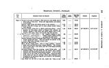
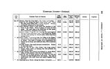
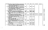
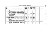
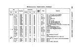
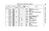
Show HOMEWARD JOURNEY- Continued. DAXB. 1850. Sept. 8 « 4 PaaxnrazR Poors ASD RIMAEKH. CACHE CIVE and a tributary- The Cave is in the bluffs, half a mile north of the road. Grass and sage plenty, and cedars on the bluffs. SUMMIT- The hill is long, and in some places pretty steep; road smooth. YELLOW CREEK- Camp No. 6- Half a mile below forks. A fine meadow on this creek, which is fringed with willows; no timber; stream 8 feet wide, and sharp banks- hill, to descend to this camp, steep, but smooth, and firm ground. Tut N L K t* L E a- High poi n te 11 r ks: basaltic masses of con-glomerate; vemcnted pebU^. Needle Creek, a small rivulet that join* Yellow Creek, in n. 1 j crossed near this point. SUMMIT between Yellow Creek and Bear River- The ascent and descent gentle and easy. The road should be carried to the south a half mile, through a lower level. BEAR RIVER- Right bank ; ford on large pebbles ; current swift, and river 400 feet wide- depth variable. The bottom land is here half a mile wide, and the river banks covered with cotton wood. SULPHUR CREEK- Near the crossing; creek 10 feet wide. An excellent spring of good water on the south; and a short distance east, several strong sulphur springs. A bed of coal crops out in the bluff on the north side. About one mile south, there are the tar springs, where this substance can be gathered for greasing wagons, and is said to be beneficial for galled horses, & o. RIM BASK- At the foot of the hill, called the " Rim of the Intermediate Distance. 2.24 8.16 .66 1.45 .88 6.86 1.85 .94 1.98 4.29 Doy* « March. 16.87 Total from Salt Lake City. 77.04 80.20 80.76 82.20 88.08 89.44 91.29 92.28 94.16 98.46 Latitude. 41° 09' 00". 2 41° 08' 08". 2 Longitude. 111° 14' 18" 111° 01' 22" to o § \ fcr » H o £ |


