| OCR Text |
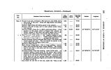
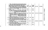
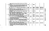
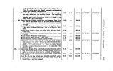
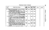
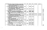
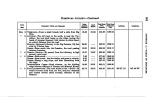
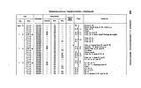
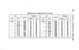
Show 294 APPENDIX A.- DISTANCES TO SAN PETE. DISTANCES FROM THE STATE- HOUSE, City of the Oreat Salt Lake, to the Settlement in the San Pete Valley, on a branch of Sevier River. Communicated from the San Pete Company's Journal Fammmr Poms AHD CAJOTOG DBTAHCB. To Kahyon Creek Bridge. , " Mill Creek " First Cotton- wood Creek " Bishop Crosly's , " Second Cotton- wood Creek " Forks of Road " Dry Creek " Willow Creek " Hot Springs « « Summit of Hill at Jordan Kanyon " Dry ( Utah) Creek " American Spring .' , M American Creek « « Marsh Creek , " Cedar GroTe " Timpanogas River , " Spring Base of the Mountains ** Spring Creek ^ <* Pimquan Creek " Pequinnetty ( Spanish Fork) Creek , " Clear Creek " Petenete Creek " Aph " " Wa- ka- tiky ( Summit Creek) " Pungun- Ghost Spring " Warm Spring Creek " Watage " At 8} miles take left- hand road " Ona- pah ( Salt) Creek at kanyon " Kanyon Forks " Third Crossing of Ona- pah , " Summit leaving Ona- pah Valley " Pleasant Creek, in San Pete Valley , " Springs in Slough * « San Pete Creek " San Pete Crossing , " Timpa Creek <( Mouna Creek M " City Creek, 12 feet wide 9 2 8 1 H 8} 2} 2f 2 3 H 3 2i 1 1 6 8 2* % n H 8} 2 2* 8 6& Jf If l| 9} 2 * i 6} 8} Hi 12; 14 " I 20* 28 26 S3 34* 88} 43} 46 51} 62} 63} 59} 621 64f 68 70} 78 78* 82 90} 92} 96} 98} 104 110} 112} 114} 1234 125} 180} NOTE.- The San Pete Settlement was began in 1849, and in 1860 a city was laid out by the Presidency. The distances measured by an Odometer, attached to a wagon. This is on the road to Iron City, in the Little Salt Lake Valley, and the southern road to California. |


