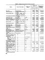
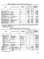
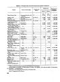
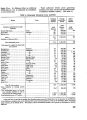
| OCR Text |
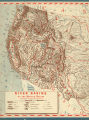
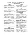
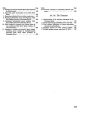
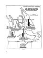
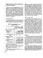
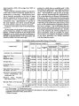
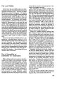
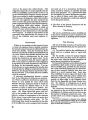
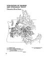
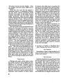
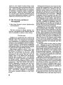
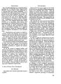
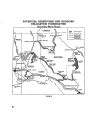
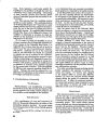
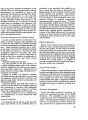
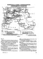
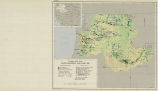
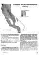
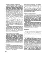
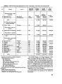
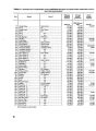
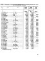
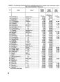
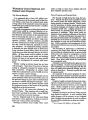
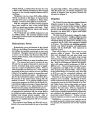
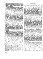
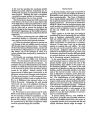
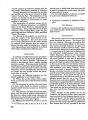
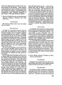
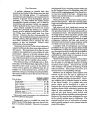
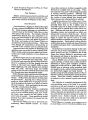
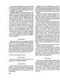
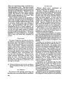
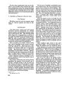
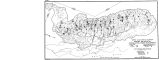
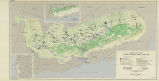
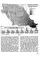
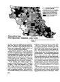
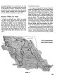
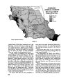
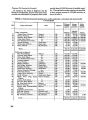
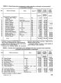
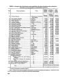
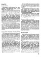
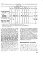
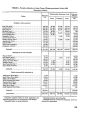
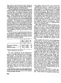
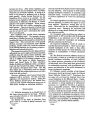
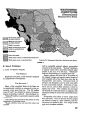
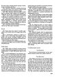
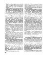
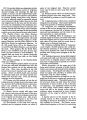
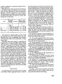
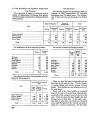
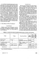
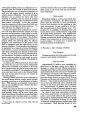
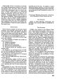
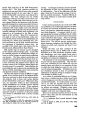
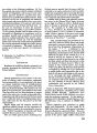
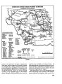
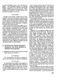
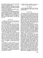
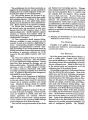
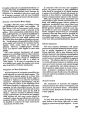
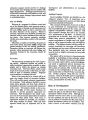
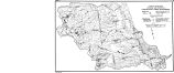
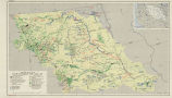
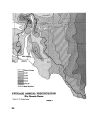
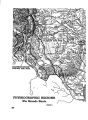
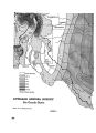
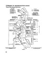
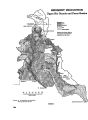
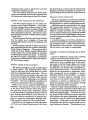
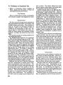
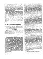
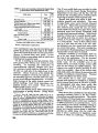
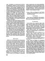
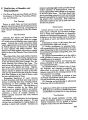
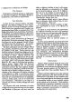
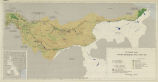
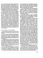
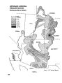
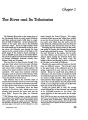
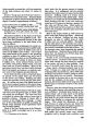
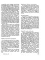
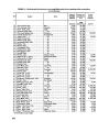
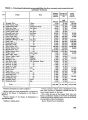
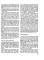
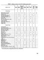
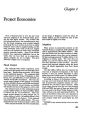
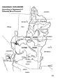
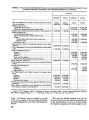
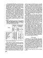
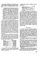
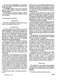
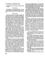
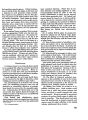
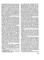
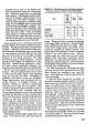
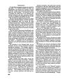
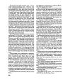
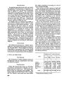
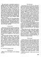
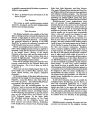
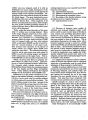
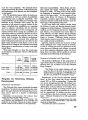
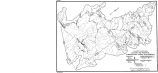
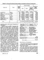
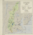
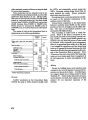
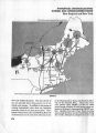
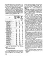
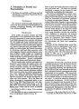
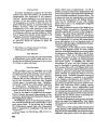
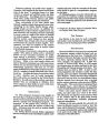
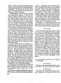
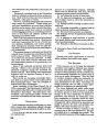
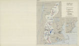
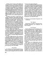
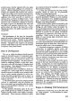
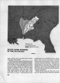
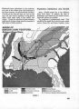
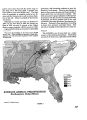
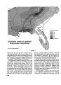
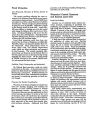
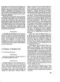
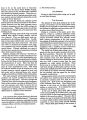
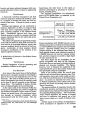
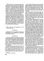
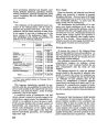
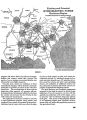
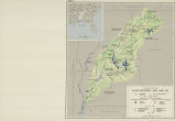
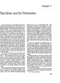
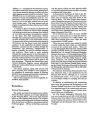
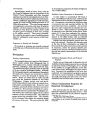
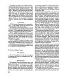
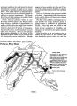
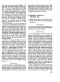
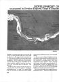
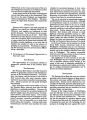
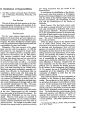
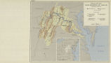
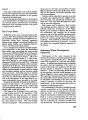
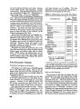
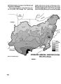
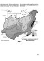
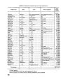
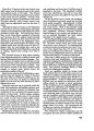
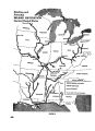
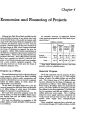
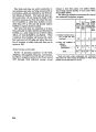
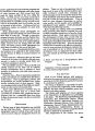
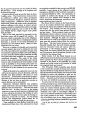
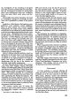
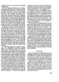
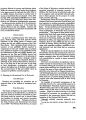
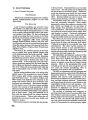
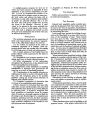
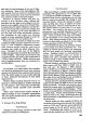
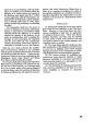
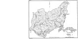
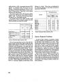
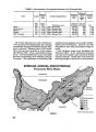
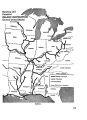
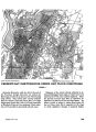
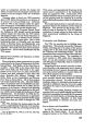
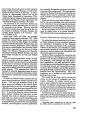
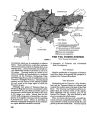
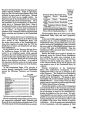
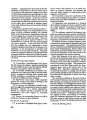
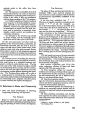
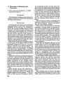
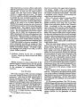
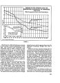
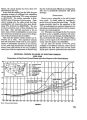
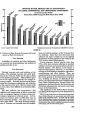
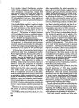
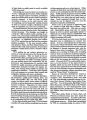
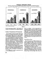
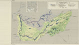
Show facturing furnished only 12 percent of the total income of the basin as compared with 22 percent in the Nation as a whole. Furthermore, much of the gain has been concentrated along the eastern border, scarcely touching some areas greatly in need of additional employment opportunity. Regions Within the Basin Despite its similarity from locality to locality over great areas, regional diversity also deserves emphasis. In planning for basin development, sev- eral distinct regions can be delineated. The Rocky Mountain region, the Colorado Piedmont, the Northwestern ranching section, the plains, the Sand Hills, the Flint Hills, the Black Hills, the eastern border, the Ozark Highland, and the lower Missouri flood plain differ significantly from each other. The Rocky Mountains The western margin of the Missouri Basin lies along the Continental Divide in the Rocky Moun- tains. The higher parts of these mountains have long, cold winters and short, cool summers. Snow accumulates in the winter, and melts in the late spring and early summer. Summer rainfall is gen- erally so light that grass and brush are sufficient to prevent erosion. The vegetation of these high- mountain areas is relatively slow-growing timber and brush or mountain grasses. Scattered among the mountains are open, comparatively fiat "parks" and mountain meadows covered with grass. Streams issuing from these mountains are inten- sively used for irrigation and domestic purposes. Consequently the cover must be so managed as to provide maximum quantities of water while at the same time retarding flash floods and preventing erosion. Some of the granites are subject to serious erosion when not adequately protected by a vegetal SUB-REGIONS Missouri River Basin FIGURE 3. 165 |