| OCR Text |
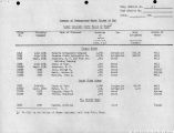
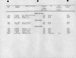
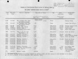
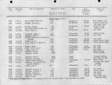
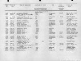
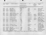
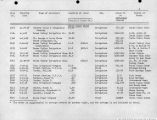
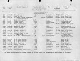
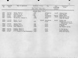
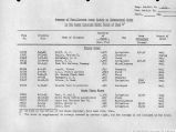
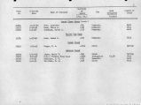
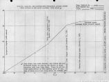
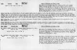
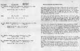
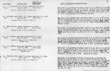
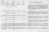
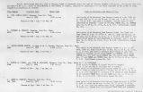
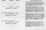
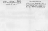
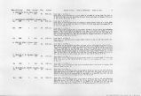
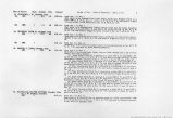
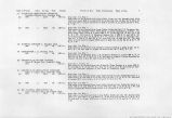
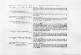
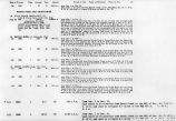
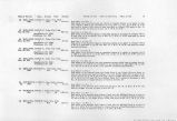
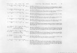
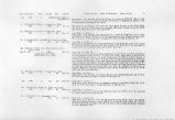
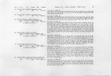
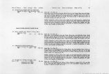
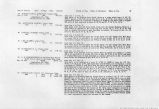
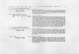
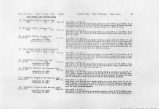
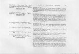
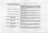
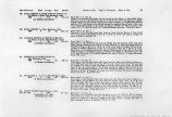
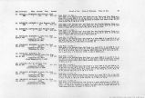
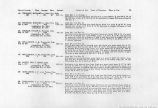
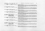
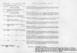
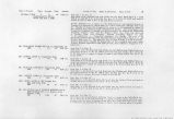
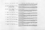
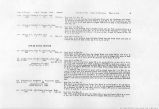
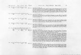
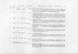
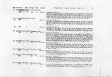
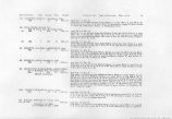
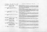
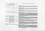
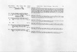
Show Date of Priority Class Acreage Duty Amount Period of Use. Point of Diversion. Place of Use. 18 79. VIRGIN CANAL COMPANY, Virgin, Utah Dec. 17, 1913 3 920 10.0 c.i.s. (Application No. 5554) ... . (Proof Due Dec. 15, 1926) 79A. MATHEWS, DANIEL, Virgin, Utah. . 1870 1 . 18.5 55 0.34 c.f.s. 80. BARNEY, JOSEPH, Virgin, Utah. 1862 1 7.0 55 0.13 c.f.s. 81. LEE, ELISHA, Virgin, Utah. 1862 1 n.2 S5 82. FLANIGAN, D. A., Virgin, Utah. 1870 1 60.0 55 0.2G c.f.s. 1.09 c.f.s. 83. A. B. CHRISTENSEN & NATHANIEL BALDWIN, 3474 S. 23rd E., Salt Lake City, Utah. Mar. 26, 1923 3 40,000 375.00 c.f.s. (Application No. 9266) (Proof Due Dec. 1, 1926) . I HURRICANE CANAL CO., Hurricane, Utah 1893 1 495.0 55 9.00 c.f.s. . . 2 1346.4 55 24.48 c.f.s. from Jan. I to Dec. 31. . •'•*'.¦ , - ' ., .- Said water to be diverted from North Creek at a point which bears S. 36° W. 2904 ft. distant of the NE Cor. of Sec. 12, T. 41 S, R. 12 W., from where it wiH be conveyed by means of a canal for a distance of 26,400 ft. and there used to irrigate 920 acres of land embraced in Sees. 21, 22, 23 and 27, T. 41 S., R. 12 W. from Jan. 1 to Dec. 31. ' . .: . Said water to be diverted from North Creek into the Daniel Mathews Ditch at a point 130 ft. N. and 250 ft. W. of the E% Cor. of Sec. 14, T. 41 S., R. 12 W; and used to irrigate 18.5 acres of land described as follows: 17.5 acres in Sec. 14; I.Q acres in Sec. 23, T. 41 S.f R. 12 W. . . . . . -. "-. from Jan. 1 to Dec. 31. Said, water to be diverted from the Virgin River into the Virgin City Mill Race at a point 1150 ft. N and 400 ft. W. of the SE Cor. of Sec. 22. T; 41 S., Rl 12 W, and used to irrigate 7.0 acres in the NWH of NE}4 of Sec. 27, T. 41 Si, R. 12 W- from Jan. 1 to Dec. 31. Said water to be diverted from the Virgin River into the Virgin City Mill Race at a point 1150 ft. N. and 400 ft. W. of the SE Cor. of Sec. 22, T. 41 S., R. 12 W. and used to irrigate 11.2 acres of land in the NE}4 NW& Sec. 27, T. 41 S., R, 12 W, from Jan. 1 to Dec. 31, Said water to be diverted from the Virgin River by means of a pump at a point 500 ft. N. and 1300 ft, E. of the SW Cor. of Sec. 23, T. 41 S., R. 12 W. and wed to irrigate 60.0 acres of land described as follows: 23.2 acres in Sec. 23, and 3.2 acres in Sec. 22; 33.6 acres in Sec. 26 T. 41 S., R. 12 W. from Jan. 1 to Dec. 31. Said water to be diverted at a point N. 51°00' E. 16,400 ft. from the NE Cot. of Sec. 2, T. 42 S., R. 13 W., Salt Lake Base and Meridian, and conveyed in a canal. a distance of 150,000 ft. and there used the entire year to irrigate 40,000 acres of land embraced in parts of Sees. 26 to 34, inclusive, T. 41 S., R. 14 W; WJ4 of Ts. 42 and 43 S., R. 13 W; parts of Sees. 1, 2, 6, 7, 11 to 15 and 21 to 36 incl., T. 42 S.» R. 14 W; all T. 43 S., R. 14 W; parts of Sections 1, 2, 11 to 36 inclusive, T- 43 S., R. 15 W; parts of Sees. 23S 24, 29, to 36, inclusive, T. 43 S., R. 16 W. . from Jan. 1 to Dec. 31. Said Water to be diverted from the Virgin River at a point S. 15* E. 1217 ft. from the NW Cor. of Sec. 29, T. 41 S., R. 12 W and used to irrigate 1841.4 acres of las£ NOTE: Waters available to be distributed between St. George & Washington Canal Co., Hurricane Canal Co., and LaVerkin Bench Canal Co. shall be distributed as follows: Of the first 45 cf.s Hurricane shall receive 20%. Of any amount between 45 cf.s. and 110 c.f.s. Hurricane shall receive 26%. Of any amount between 110 and 131.5 c.f.s; Hurricane shall receive 35.25%. Said water t6 be determined by taking the sum of the amounts in the Canals of the three main companies measured at-the three points as follows:, In the St. George & Washington Canal Co. canal at the Sproul Headgate; in the Hurricane Canal Co. canal at a point immediately above the first diversion lateral at the Town of Hurricane; in the LaVerkin Branch Canal-Co, canal immediately, above the entrance, to the tunnel.••• ".•••' |


