| OCR Text |
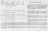
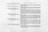
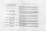
Show 258 . IRRIGATION INVESTIGATIONS IN UTAH. From this reservoir two laterals are taken out, one on the west side 3 miles long, leading to the main fields, and the other on the east side one-half mile long. The head of the ditch has been cut through the sandstone banks of the canyon at the eaet side of the dam (PI. XVIII, fig. 3). The construction of the dam at the head of the ditch presented difficulties similar to those encountered on Virgin River (see page 214), namely, finding a solid foundation in the sandy bottoms of the stream, and they have been likewise overcome by throwing the channel of the stream over a rock ledge. The present dam at Kanab is also the successor of numerous less substantial ones. It is 300 feet long, 04 feet high, and has a bottom width of 300 feet. The rock spillway at the east end is 20 feet wide and 200 feet long, and has been cut out of the rook bank of the canyon. When measured on June 30,1902, 50 feet below the head gate, Kanab Ditch was carrying 4 cubic feet per second. This was the entire flow of the creek, and was said by the owners of the ditch to be the normal How for most of the irrigating season. This is the amount of water available for irrigating the 750 acres farmed in Kanab settlement, which is but 1 cubic foot per second for each 187.5 acres. It is also the amount of water $70,000 has been spent to control and a dam 300 feet long and 64 feet high built to divert. The right to this water is vested in the Kanab Irrigation Company, which was incorporated December 13, 1881. This company was at an early date awarded the water of Kanab Creek between Upper Kanab and the gap in the canyon below the Kanab fields by the selectmen of Kane County, sitting as water commissioners, and shares of stock in the company in proportion to their respective rights in the water as established by past usage have been issued to the individual stockholders. Because of its extreme scarcity the water at Kanab is carefully husbanded. To avoid night irrigation two small reservoirs, one of which is shown in PI. XVIII, fig. 3, are used for storing the night flow of the ditch. The lower reservoir, which has a capacity of approximately 00 acre-feet, is generally filled several times from the higher water in spring. The two laterals leading from the upper reservoir carry approximately 4 cubic feet per second each, that amount being considered an irrigation .stream. For each share in the company one of these streams is delivered to the irrigate rs for four minutes each watering, and from five to seven shares are required to water each acre. Shares sell at from $8 to $9, making the cost of water from $40 to $00 per acre. The principal crop grown is alfalfa. As sufficient for local needs is not raised, the price of this product,as well as of mos; other products consumed at Kanab, is determined by the cost of hauling the same product from the valley of Sevier River, 100 miles north. IPPER KANAB AND FREDONIA. The use of water at Upper Kanab and Fredonia is small. At Upper Kanab 127 acres are watered, the water being divided into 7 parts, 2 of which cover 50 acres, 1 covers 17 acres, 1 covers 20 acres, and 3 cover 40 acres. The title is based on the awards of the county selectmen. At Fredonia 300 acres are watered. The water there is controlled by the Consolidated Irrigation and Manufacturing Company, which was incorporated February 23, 1889, with a capital stock of $1,800, divided into '"330 .shares of dams, reservoirs, and ditches, together with the water of Kanab Creek'' below the Fredonia Field Dam. |
| Source |
Original book: Utah exhibits [of the] State of Arizona, complainant, v. State of California, Palo Verde Irrigation District, Imperial Irrigation District, Coachella Valley County Water District, the Metropolitan Water District of Southern California, City of Los Angeles, City of San Diego, and County of San Diego, defendants, United States of America and State of Nevada, interveners, State of New Mexico and State of Utah, parties |


