| Title |
Annual Report of the Commissioner of Indian Affairs - 1893 |
| Subject |
Indian reservations; Federal government; Indians of North America; Indians of North America--Education; Courts; Allotment of land; Land use; Railroads; Timber; White people--Relations with Indians; Health; Annuities; Horses; Crime; Missionaries; Irrigation; Grazing; Natural resources; Education; Water rights; Alcohol; Indigenous peoples--North America |
| Keywords |
Annual Report; Indian Agency; Reservations; Allotment; Land Rights; Resources; Tribal Funds; Native Americans |
| Publisher |
Digitized by J. Willard Marriott Library, University of Utah |
| Tribe |
Ute |
| Band |
Uintah; Uncompahgre |
| Language |
eng |
| Description |
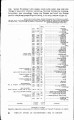
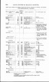
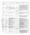
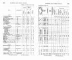
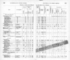
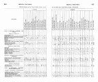
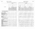
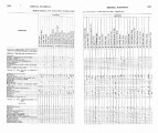
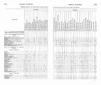
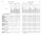
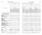
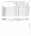
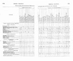
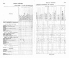
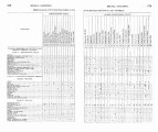
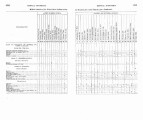
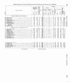
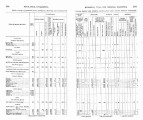
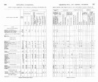
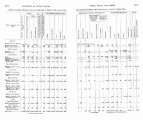
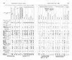
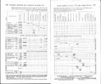
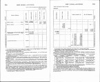
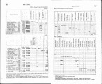
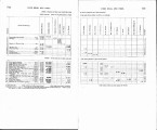
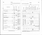
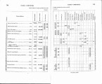
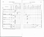
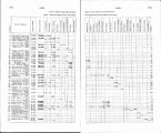
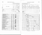
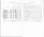
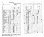
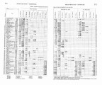
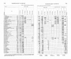
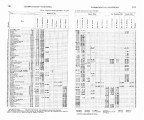
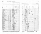
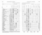
Excerpts concerning Utah from the Annual Report of the Commissioner of Indian Affairs - Courtesy of the University of Wisconsin Digital Collections. The Commissioner of Indian Affairs describes the rationale behind Indian policy, attendance and performance at Indian schools, the lease and use of land not alloted to the Indians, and appropriations made to the various tribes. The Commissioner also describes agreements rendered with the Southern Utes. The Uintah Ouray Agent submits a report outlining his time at the agency, the condition of schools and land on the Uintah Reservation, annuity payments, the progress of livestock raising, and conditions on the Uncompahgre Reservation |
| Type |
Text |
| Coverage |
Uintah and Ouray Indian Reservation (Utah); Utah; Washington (D.C.) |
| Format |
application/pdf |
| Rights |
Digital Image © 2011 America West Center. All Rights Reserved |
| ARK |
ark:/87278/s60g6ftr |
| Creator |
Commissioner of Indian Affairs; Waugh, Robert |
| Date |
1893 |
| Spatial Coverage |
Uintah and Ouray Indian Reservation (Utah); Utah; Washington (D.C.) |
| Setname |
uaida_main |
| ID |
371913 |
| Reference URL |
https://collections.lib.utah.edu/ark:/87278/s60g6ftr |