| OCR Text |
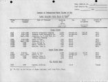
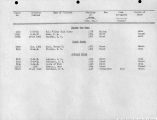
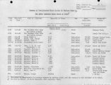
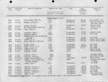
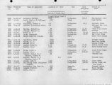
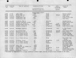
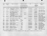
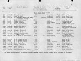
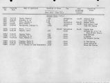
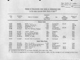
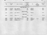
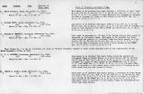
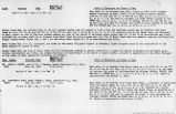
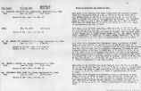
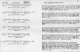
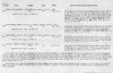
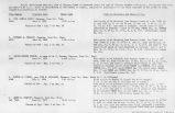
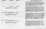
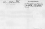
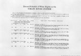
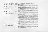
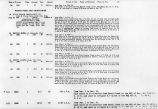
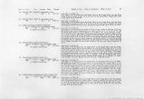
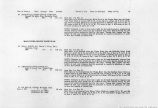
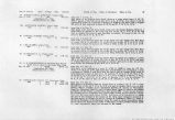
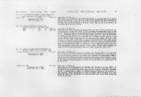
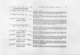
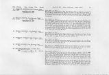
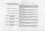
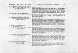
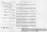
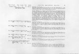
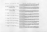
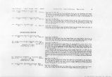
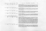
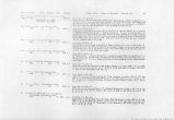
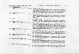
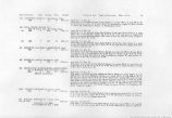
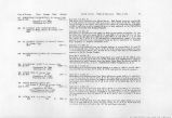
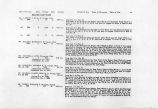
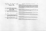
Show Date of Priority Class Acreage Duty Amount 108. PACE HENRY A. HIGH WATER DITCH CO., c/o Henry A. Pace, New Harmony, Utah. 1869 1 67.0 60 1.12. ci.a. ^A Mutual Association) 109. PACE, HENRY A^ New Hannony, Utah. 186a t 3.0 60 0.05 cf.s. 110. LAWSON SPRING & DITCH COMPANY, c/o Henry A. Pace, New Harmony, Utah. 1860 1 79.9 60 1.33 cf.s. (A Mutual Association) Period of Use. Point of Diversion. Place of Use. 23 111. PRINCE & TAYLOR DITCH CO., New Hannony, Utah. 1860 1 40.7 60 .68 cf.s. (A Mutual Association) 112. PACE, MRS. L. A., et al., New Hannony, Utah. 1870 1 46.5 60 0.78 cf.s. (A Mutual Association) 113. DAVIS, REESE, New Harmony, Utah. June 30, 1913 3 200, (Application No. 5301) (Certificate No. 1143) 3.0 cf.s. from Mar. 1 to Oct. 31. Water to be diverted from Main Canyon Creek into the Henry A. Pace High Water Ditch at a point in the SWy£ of Sec. 21, T. 38 S., R. 13 W. and used as a supplemental supply for the Lawson Spring and Ditch Company to irrigate 67.0 acres in said Sec. 21. Said water to be divided among the owners thereof each in the ratio of his individual acreage to the whole acreage as follows: (1) Henry A. Pace, 57.0 ••cres; (2) L. A. Pace 4.0 acres; (3) Gottlieb Schmutz 6.0 acres. Total 67.0 acres. irom April 1 to Dec. 1. Said water to be diverted from Main Canyon Creek into the Henry A. Pace Ditch No. 2 at a point in the SW^4 of Sec. 21, T. 38 S., R. 13 W. and used to irrigate 3.0 acres of land in said Sec. 21. from April 1 to Dec 1. Said water to be diverted from Lawson Spfing into the Lawson Ditch and.from Main Canyon Creek into the Henry A. Pace Ditch No. 1 (both diversions being in the SWJ4 SZ% of Sec. 21, T. 38 S., R. 13 W.) and used to irrigate 79.9 acres described as follows: 62.9 acres in Sec. 21; 17.0 acres in Sec 22, T. 38 S., R. 13 W. Said water to be divided among the owners thereof each in the ratio of his individual acreage to the whole acreage as follows: (1) Henry A. Pace 54.4 acres; (2) L. A. Pace 9.9 acres; (3) Gottlieb Schmutz 6.0 acres; (4) Jas. L. Prince 9.6 acres. Total 79.9 acres. from Jan. 1 to Dec. 31. Said water to be diverted from Ash Creek into the Prince and Taylor Ditch at a point 1800 ft. N. and 100 ft. E. of the SW Cor. Sec. 22, T .37 S., R. 13 W. and used to irrigate 33.7 acres of land described as follows: 16.8 acres in Sec. 22 and 16.9 acres in Sec. 27. Said water to be divided among the owners thereof each in the ratio of his individual acreage to the total acreage as follows: (1) Jas. L. Prince 2.8 acres; (2) Jas. E. Taylor, 11.0 acres; (3) Geo. F. Prince 9.3 acres; (4) William Prince 17.6 acres. Total 40.7 acres. from April 1 to Dec. 1. Said water to be diverted from Ash Creek into the Pace and Prince Ditch at a point 1900 ft. N. and 600 ft. E. of the SW Cor. of Sec. 22, T. 38 S., R. 13 W. and used to irrigate 46.5 acres of land described as follows: 34.8 acres in Sec. 22, and 11.7 acres in Sec. 27. Said water to be divided among the owners thereof each in the ratio of his individual acreage to the total acreage as follows: (1) Mrs. L. A. Pace 13.0 acres; (2) Reese Davis 6.0 acres; (3) Geo. F. Prince 12.3 acres; (4) Jas. E. Taylor 15.2 acres. Total 46.5 acres. from Jan. 1 to Dec. 31. Said water to be diverted from Ash Creek at a point N. 17*46' E. 2151 ft. distant of the SE Cor. of Sec. 21, T. 38 S., R. 13 W. from where it will be conveyed by means of a ditch for a 3istance of 6800 ft. and there used to irriagte 200 acres of land embraced in Sees. 23 and 26, T. 38 S., R. 13 W. |
| Source |
Original book: Utah exhibits [of the] State of Arizona, complainant, v. State of California, Palo Verde Irrigation District, Imperial Irrigation District, Coachella Valley County Water District, the Metropolitan Water District of Southern California, City of Los Angeles, City of San Diego, and County of San Diego, defendants, United States of America and State of Nevada, interveners, State of New Mexico and State of Utah, parties |


