| OCR Text |
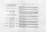
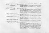
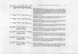
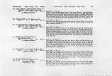
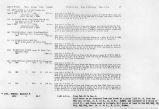
Show 252 IRRIGATION INVESTIGATIONS IN UTAH. Formerly cotton was raised at St. Thomas, 500 pounds of lint to the acre being the average yield for the medium class soil. None has been raised for two years. It is considered a profitable crop at 8 to 10 cents per pound. Water at St. Thomas is valued at $20 to $25 per acre. Unimproved land under ditch, with a chance to get water, can be purchased for $5 per acre. The cost of ditch maintenance is nominal. OVERTON. There are six ditches at Overton, aggregating 11 miles in length, and watering 776.5 acres in holdings of 30 acres. The largest is Overton Ditch, which waters 271.5 acres. This ditch divides one-half mile above Overton into Perkins Ditch and Overton Town Ditch. April 18, 1902, Perkias Ditch, measured 50 feet below the division box, was carrying 4.05 cubic feet pel second, and Town Ditch, measured 150 feet below the division box, was carrying 7.79 cubic feet per second, a total of 11.84 cubic feet per second, which, distributed over the 271.5 acres, gave a duty at that season of 1 cubic foot per second to each 23 acres. The next largest ditch is String-town Ditch, which waters 138 acres in the settlement of Stringtown, directly across Muddy Creek from Overton. Although all of the ditches at Overton are subject to the Muddy Valley Irrigation Company, no uniform system of management or distribution is followed. A water master distributes water on a basis of the whole of Town Ditch to each acre under it for one hour each week, and the whole of Perkins Ditch to each acre under it for two hours each week. Regular distribution is followed from April 1 to September 1 only; at other times each user takes what water he desires at *;imes convenient to him. Land at Overton is valued at $2.50 to $10 per acre, the latter being comparatively choice and having some improvements. Although capitalized at $1 per acre, water usually sells for $10 per acre. LOGAN. \ At Logan, 4 miles above Overton, five ditches, aggregating 5 miles in length, water 421 acres in holdings averaging 35 acres. The largest ditch is the St. Joe Ditch, which waters 217 acres north and east of Logan. When gauged April 1'/, 1902, 100 feet below the head, it was carrying 6.5 cubic feet per second, giving a duty on the 217 acres watered of 1 cubic foot per second to each 33 acres. The next largest is Logan Ranch Ditch, which waters 80 acres. April 20, when the head gate was badly choked with aquatic growth, the ditch was carrying 2.83 cubic feet per second, or 1 cubic foot per second to each 28 acres. No regular system of distribution is followed on any of the ditches and there i*> no local organization in charge. Above Logan and in the neighborhood of Moapa Indian Reservation 350 acres are watered from a number of small ditches. \ rioville. At Rioville, where Virgin River joins the Colorado, Daniel Bonelii irrigates 100 acres from Virgin River through a ditch If miles long, which heads on the right bank of the river. During the summer months, when the flow in the river is very |
| Source |
Original book: Utah exhibits [of the] State of Arizona, complainant, v. State of California, Palo Verde Irrigation District, Imperial Irrigation District, Coachella Valley County Water District, the Metropolitan Water District of Southern California, City of Los Angeles, City of San Diego, and County of San Diego, defendants, United States of America and State of Nevada, interveners, State of New Mexico and State of Utah, parties |


