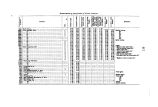
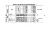
| OCR Text |
Show NOTES ON THE GEOLOGY OF NORTHEASTERN NEW MEXICO. BY O. ST. JOHN, I In the region of the headwaters of the Canadian is embraced a territory which, for the completeness of its geological record and the interest of its concomitant topographical and scenic features, is not excelled perhaps by a similar extent of country in the West. It is bounded on the west by the Spanish range, which in this part of its course consists of a densely- wooded watershed- divide, 9,000 to 11,000 feet in altitude, from which at intervals lofty lateral spurs are thrown off, whose bald summits overtop by 1,000 to 2,000 feet the actual watershed, whiclj latter extends in a general north- south direction. Near the Colorado line, the range is intersected by the Baton Mountains, a range of gladed hills extending eastward forty or fifty miles, and constituting, with the still easterly prolongation in the Chicorica Mesa, the northern limits of the district, which opens out to the southeastward into the great plain. Thus defined, the district comprises an area of about twenty- five hundred square miles. During the season of 1869, in the progress of his extended reconnaissance of the Rocky Mountains, Dr. Hayden visited this region, from whom we have authentic account of its general geological features, and their intimate relation to those prevailing in other and similar districts to the north and south. A few months' residence in this part of the country in 1874-' 75* afforded the writer opportunity to become somewhat familiar with its geological features; and the purpose of the present communication is to present such facts as may tend to contribute something toward a similar knowledge of remote and perhaps hitherto rarely- visited localities, and their connection with already examined districts. THE UPPER BASIN OF THE CANADIAN. In the mountains along the western boundary of the district, many little streams take their rise, which, flowing southeasterly across the great Tertiary plateau, whose surface they score with rugged gorges and beautiful little valleys, finally emerge into the upper basin of the Canadian. This basin forms one of the peculiar and interesting features of the region, and which deserves passing notice, as well on account of its scenic surroundings as the important part it must eventually take when the time arrives for utilizing its thousands of acres of fertile irrigable lands. Among the most important of these tributaries are the Yermejo and the Cimarron; the affluent which retains the designation of the principal stream rising in the plateau, its drainage being entirely derived from the Baton ridge. A short distance below the mouth of the * It U with peculiar pleasure the writer seizes the opportunity to express his acknowledgments to his friends Messrs. Frank Springer and W. R. Morley: to Mr. Springer he owes the possibility, of a pleasant sojourn of several months at Cimarron; and to Mr. Morley he is indebted for valuable data, especially relating to the topography and hypsometry of the country. No. 4 1 |


