| OCR Text |
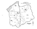
Show The average annual stream flow from the Wasatch Range is 173,400 acre- feet. The Oquirrh Mountain streams average only 4,400 acre- feet. See Table 5- 4 for a detailed breakdown of these figures. The average annual flows in Table 5- 4 for the Wasatch Range mountain streams and Oquirrh Mountain streams is taken from the Salt Lake County Area- Wide Water Study, published in 1982, and reflect data through 1981. Flows for the ungaged streams were estimated through comparison with gaged streams by use of the area- altitude- precipitation method. The U. S. Geological Survey ( USGS) currently maintains five streamflow gauging stations in the Jordan River Basin. In addition to the existing USGS stations, in the past stations have been located on the Jordan River and tributary streams. Although no longer in use, these discontinued stations are a valuable source of streamflow data. One station was located in the Jordan Narrows ( 10167000) downstream of the diversion structures for the East Jordan Canal and the Utah and Salt Lake Canal. This station, although discontinued in 1990, collected Table 5- 2 PRESENTLY DEVELOPED WATER SUPPLIES Jordan River Basin Source Description Average Annual ( ac- ft/ yr) Surface Water Irrigation 140,000 Public supply - Wasatch Range streams 68,190 Supply to wet/ open areas 94,500 Secondary 10,000 Private industrial 3.200 Subtotal 315,890 Groundwater Public supply wells and springs 114,400 Private domestic 24,600 Self- supplied industrial 26,500 Irrigation wells 3,000 Artificial groundwater recharge 5.800 Subtotal 174,300 Imported Water Tooele County 10,000 Deer Creek Reservoir 61,700 Central Utah Project 70,000 Welby- Jacob Exchange 29.400 Subtotal 171,100 Basin Total 661,290 Historically, surface water sources were first developed for irrigation, while groundwater provided for domestic and culinary needs. With the increasing population, a series of exchanges were employed to convert the highest quality surface water to municipal and industrial use. Consequently, Wasatch Range streams now provide an annual average 68,190 acre- feet for public water supplies. more than 75 years of streamflow data at the Jordan Narrows location. Table 5- 5 lists the past and present basin stream gauging stations along with the years of record and average annual flow. Figure 5- 2 shows the location of the existing USGS gauging stations and the discontinued stations. 5- 4 |


