| OCR Text |
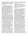
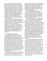
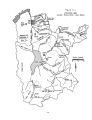
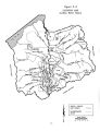
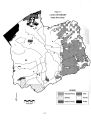
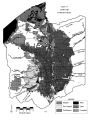
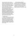
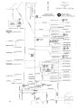
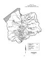
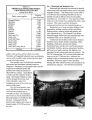
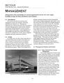
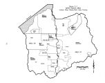
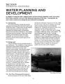
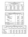
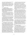
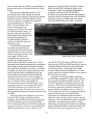
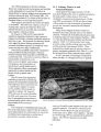
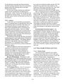
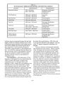
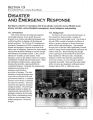
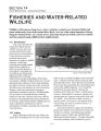
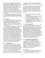
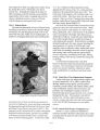
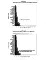
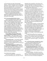
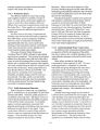
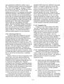
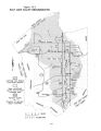
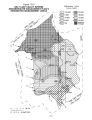
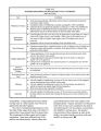
Show • ••••••• •% V* s • • • •* s 4 • " • ••••••• ,••••>•• • ••••/•%•• ' ••••••••>••* • • * ••••••••• * • • • •%••••••' , • *• - •••••••••• ••••••• • • •• ••••••••• « • •;•;•;•>;• -•-- TO; . •%••••••••%••%•• • ••••• • +*• » % V X *•••%•••••' Figure 3- 4 LAND USE Jordan River Basin •••••• •••••, •%••• « ••••' » ••••••••••••••••••••. •••••••• ft< • • • •••• • • > •>•••••••• • ••••••< •• - V* vrv4*^ ••* *• • •••••< • ••••••• » • • > V ft" v4V#\ V *••••• • •••••••••• • v ^ * - v# V* •••*•< • •*•'•"•••••••• W4T • /•• i V • • » • •••••• •••••••••••• * •••* * ••••••••• • ••••••••••' % •>•••* > v • v • * 4 • • • 4 - ** » ••••••• *•••• 4* / • ~; • •••••* v * A • » •' •- • • •* • •- • •••••••*• ^ » ••••• % i • • » •*• •*•*•*••• • w •••••• • « > • • • Little Cottonwood Creek N 0 12 3 4 5 SCALE ( miles) 3- 10 ^^^ Irrigated Dry Cropland Wet/ Meadow |