| OCR Text |
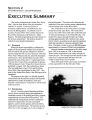
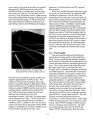
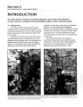
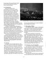
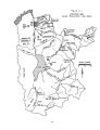
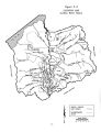
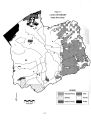
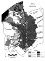
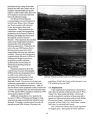
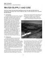
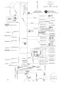
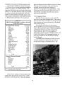
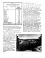
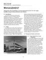
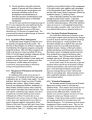
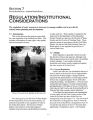
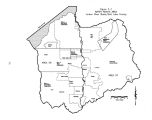
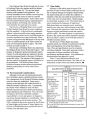
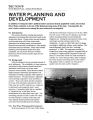
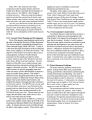
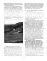
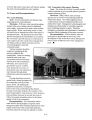
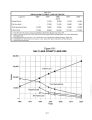
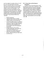
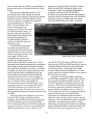
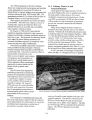
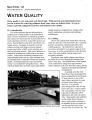
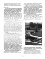
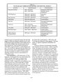
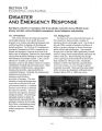
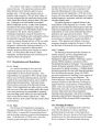
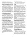
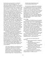
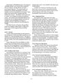
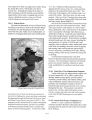
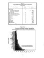
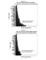
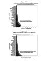
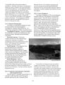
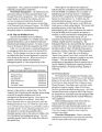
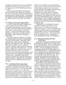
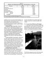
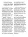
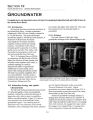
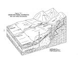
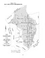
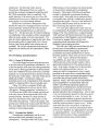
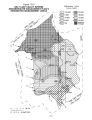
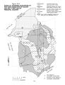
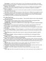
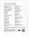
Show SECTION 3 STATE WATER PLAN - JORDAN RIVER BASIN INTRODUCTION An orderly process is needed to describe the planning, conservation and development of water resources. It should provide the flexibility to adjust as future conditions change. 3.1 Background This section includes some general planning guidelines and the organizational arrangements used in preparing the basin plan. It also includes a general physical description of the Jordan River Basin ( Salt Lake County). The Board of Water Resources and the Division of Water Resources have a leadership role in water planning and development, and in coordinating water planning activities with the other state and federal agencies. Formulation of basin plans fits within the state water policy framework which includes regulation, water rights, conservation, development, protection of water quality and management. Municipal and industrial ( M& I), agricultural, fish and wildlife, and recreational uses are all included in the planning process. The inter- relationship of water resources demands and activities are recognized and incorporated. The Jordan River Basin Plan includes a description of significant water problems, options available to resolve them and recommendations for future action. One main purpose is to identify problems which need early attention. Each 1 1 - 1 %• MB *• r JH^ BBML i^^ pal^ r ' J^ HI [ HKASM^ P1 ' LcjsC' 1 K JB Jtt^^ A I^ HEn y ^ tut J ^ j Px9o fift. ' ••• 1* 1jd l* f# BL" mh^^ Ti ^ BIBvDMh* iTy ^ MZSHJI ' ISrfl i * i|| jj s ^ T'lyifc- jr*-** *" •** 5r| h'l Aerial photos of the Jordan River between 6800 South and 7800 South, taken in 1937 ( left) and in 1990, reveal how the river has been straightened and vast areas of wetlands filled in for agricultural and industrial developments. For further site reference, note the North Jordan Canal that appears on the left side of both photos. 3- 1 |