OCR Text |
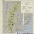
Show In the upper Rio Grande and Pecos Basins the very life of the area depends upon the effective- ness with which engineering works and land use measures are designed and carried out. This will require a broader view of public benefits and social costs than commonly has prevailed in evalu- ating such undertakings as the Middle Rio Grande Project. It also will demand a close correlation of land and water programs. Such correlation has not been practiced, and there accordingly seems urgent need for careful trial in a few pilot areas to find ways of both strengthening the economy and preserving the resources base. In the lower valley the principal potential de- velopment is the Valley Gravity Project, which would provide for irrigation of 130,000 acres of new land and supplemental supplies for 553,000 acres now irrigated. Authorization of the proj- ect was obtained as a result of a report by the International Boundary and Water Commission in 1940. The Bureau of Reclamation was desig- nated in 1941 as the agency to construct all fea- tures except those which are international in character. This authorization included drought control as a nonreimbursable item. Subsequent to this authorization, consummation of the in- ternational treaty with Mexico and the construc- tion of storage works on the Rio Grande River by the International Boundary and Water Commis- sion have led to the need for revision in the plan of project development. The Bureau of Reclamation has investigated and prepared a revised plan of development for this project. Solution of the drainage problem, which is intimately related to the irrigation de- velopment, is a major part of the plan. If facili- ties are constructed by the Bureau, practically full repayment to the Government of the cost of construction will be required. The local inter- ests recognized that the Army Engineers had been designated under flood control law as re- sponsible for construction of major drainage outlets. Hoping that they would be able to get the drainage work accomplished at less cost to them and without the 160-acre limitation re- quired under reclamation law, they asked Con- gress to direct the Army Engineers to investigate their drainage problem. Recently Congress com- plied. Its directive will involve duplication of effort. Thus project beneficiaries play one Fed- eral agency against another in order to obtain the greatest benefits to themselves at the expense of the general taxpayers of the Nation. The Connecticut and New England In contrast to the Rio Grande, the Connecticut lies in a region of rough, well watered, wooded country. Most of Vermont, New Hampshire, and central and northern Maine is broken into ridges and low mountain chains. Rainfall varies from an average of 30 to 48 inches. Stretching back from the Atlantic until it meets this moun- tain-plateau area, in a belt varying in depth from 50 to 100 miles, is a land of low hills, ridges, and valleys which crosses Connecticut, Rhode Island, eastern Massachusetts, southern New Hampshire, and southeast Maine. Where the soil is suitable, this hill area is intensively used for dairying, market gardening, and apple orchards. Yet even in this belt, except for a few small alluvial plains, the general unsuitability of the land for agricul- ture is indicated by the fact that less than 20 per- cent of the land is used for harvested crops.2 In the far northeast tip of Maine is the Aroostook Plateau where the famous potatoes are grown. Along the Vermont shore of Lake Champlain is a flat agricultural natural hay area, increasingly used for dairy production. This land mass has been carved into 19 prin- cipal drainages, all but three of which empty into the Atlantic. Most of the streams are short, with good gradients that early attracted the water- wheel industries of the machine technology born at the close of the eighteenth century. The great- est river and most extensive watershed is the Con- necticut, in whose lower reaches intensive industry and specialized agriculture have developed de- spite the handicaps of periodic floods that visit the basin. In the other watersheds, farming, which once scratched a subsistence living from, thin-soiled uplands, long since has retreated to 2 Regional Planning-Part IV, New England, National Resources Committee, Figure 27, p. 27. 29 |