OCR Text |
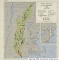
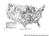
Show design, construction, and operation of water and related land resources development. Facts are essential for flood control, irrigation, hydro power, navigation, land classification, watershed treat- ment, drainage, domestic and industrial water supply, pollution abatement, recreation, wildlife refuges, the control of disease, and the improve- ment of public health, as well as for the manage- ment of fish and wildlif e. In each of these fields, physical, chemical, biological, and socio-economic facts are required. It is only on the basis of actual facts that we can properly justify, analyze, and establish priorities and integrate full development of river basin programs and projects. River Basin Unit for Information A river basin is a natural unit within which climate, rainfall, geology, topography, drainage patterns, stream flow, soils, natural vegetation, and types of land and water use are interrelated. The river basin therefore becomes a suitable unit for collection, analysis, and interpretation of its characteristic features. It is also a suitable basis for integrating the developments of several types of projects already constructed or likely to be constructed in the future. Accordingly, programs of finding and interpretation of facts should be adequate for determination of the possi- bilities of the physical features of a river basin and of regions comprising related basins. The needs of its growing population with enlarging demands should also be thoroughly surveyed. Adequacy cannot be defined once for years to come. Th.e uses for which information is sought will vary from time to time as needs expand or change. Xhe amount of data that can be ob- tained will change as techniques of resources investigation are improved and modern statistical methods are applied. Data already available have justified the de- velopment of many successful water resources projects at advantageous sites. But some projects have been overdesigned and some underdesigned. And it must be emphasized that great deficiencies now exist ior integrated developments by river basins and for more difficult project locations. Only 25 percent of the area of the United States is covered by topographic maps considered accept- able by modern standards; only 10 percent of the area has been covered by modern geologic maps. In the Southwest, all waters have been appro- priated. The fact that an important city in this area can get additional water for its increasing population only by buying irrigated land with its water rights emphasizes the importance of broad- ening our knowledge of water resources. In this instance the water is diverted into the city mains and the former irrigated fields are turned back to the desert. The gathering and analysis of basic information required for sound water resources programs is today widely scattered among both State and Fed- eral agencies. As a result, the agencies responsi- ble for the planning and carrying out of develop- ment programs must frequently supplement the information obtainable from the agencies special- izing in the gathering and compilation of data, in order to be able to go forward with specific project design. This is unsatisfactory to the extent that it means data are limited to specific project areas. Agencies Which Collect Data Among the agencies responsible for collecting and preparing the types of information required for sound water resources programs are the Weather Bureau, Coast and Geodetic Survey, Bu- reau of the Census, and Bureau of Foreign and Domestic Commerce in the Department of Com- merce; the Geological Survey, Office of Land Utilization, and Fish and Wildlife Service in the Department of the Interior; the Bureau of Agri- cultural Economics, Soil Conservation Service, Bureau of Plant Industry, Soils and Agricultural Engineering, Agricultural Research Administra- tion, and Forest Service in the Department of Agriculture; and the Federal Power Commission. In addition, agencies like the Army Engineers, the Bureau of Reclamation, the Public Health Serv- ice, and the Tennessee Valley Authority gather and analyze information to meet the needs of their separate programs. 1D0 |