| OCR Text |
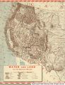
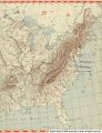
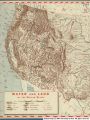
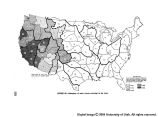
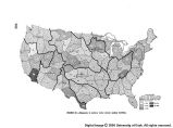
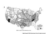
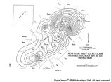
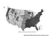
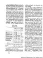
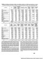
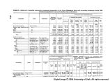
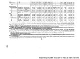
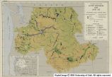
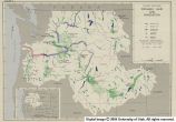
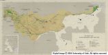
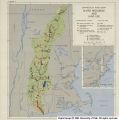
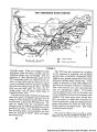
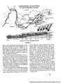
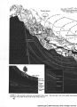
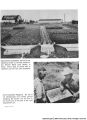
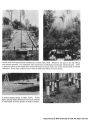
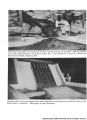
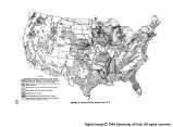
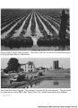
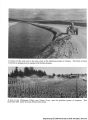
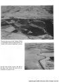
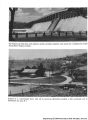
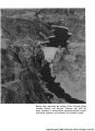
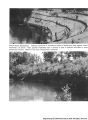
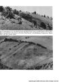
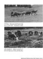
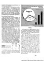
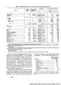
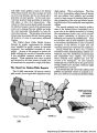
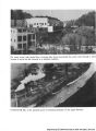
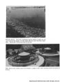
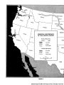
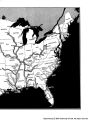
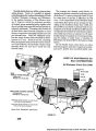
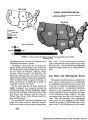
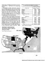
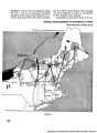
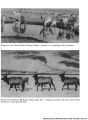
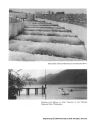
Show third agricultural development began after the Civil War, bringing new American settlers and methods to extend valley life, culminating in the railroad cities of Albuquerque and El Paso. Today, nearly all of the water produced in the Upper Rio Grande sub-basin is consumed by the time the river reaches Fort Quitman, Tex. With the exception of 60,000 acre-feet which are de- livered annually to Mexico near El Paso under the terms of a treaty of 1906, almost all of the water is used in the upper basin, and the river, in effect, breaks in two on a sandy Texas river bed. The lower valley is unaffected by flows from the Colorado and New Mexico areas. Much the same situation prevails in the drain- age area of the Pecos River. That major tribu- tary of the Rio Grande rises in the Sangre de Cristo range of New Mexico, draining a rugged mountainous region and flowing for the most part in a deep canyon. From Alamogordo Dam to Red Bluff Reservoir the Pecos cuts through a series of canyons and valleys in which irrigation has developed on a large scale, especially between Roswell and Carlsbad, N. Mex. Below Red Bluff the valley widens and the stream meanders through gently rolling hills before entering a canyon in its lowermost reaches. Scanty rainfall, high evaporation, irrigation diversions, and sandy stream beds combine to remove all of the stream flow in the lower portion of the Pecos. Of the estimated average annual water production of 1,095,000 acre-feet, very little reaches the main stream. Most of the irrigated area in the middle part of the Pecos Basin and a large part in the lower basin receive water supplies from wells and springs, and the extensive use of ground water has in turn depleted the flow of the Pecos. Below Fort Quitman, the Lower Rio Grande picks up excess discharges from tributary streams in both the United States and Mexico so that near the head of its delta it has an average annual volume of 5,261,000 acre-feet. Irrigation in the delta region above Brownsville, Tex., makes heavy demands upon the river, and there are many days when the entire flow is utilized. How- ever, 3,750,000 acre-feet are lost annually to the Gulf of Mexico because of the erratic nature of the runoff. Storage reservoirs planned by the In- ternational Boundary and Water Commission will regulate the river flows and conserve much of this for use in both Texas and Mexico. Except for a few irrigated strips upstream in the neighborhoods of Laredo, Eagle Pass, and Presidio, the agricul- ture and population of the lower valley sub-basin are concentrated in the delta area. In all three subdivisions of the basin, agricul- ture is the most important element in the economy. The processing of. agricultural and timber prod- ucts has been the most important manufacturing in the basin. Copper, gold, silver, and zinc min- ing is carried on in the upper basin; the world's largest potash production is in the Pecos Basin near Carlsbad; and oil and natural gas are im- portant products in the Pecos and lower Rio Grande areas; but there is very little mineral processing, and the mining industry does not bulk large in employment. In recent years the tourist and resort trade has become a major source of income. That, coupled with Government-fi- nanced national defense projects in the basin, has stimulated the recent growth of cities and towns. By and large it is agriculture that pre- dominates. This rests upon livestock production from the extensive range lands, coupled with crop production on 2 million acres of irrigated land. Irrigation not only supports such cash crops as vegetables in the San Luis Valley and citrus fruit in the lower valley, but also provides forage crops for the livestock industry. In the San Luis Valley and below Elephant Butte Reservoir on the Rio Grande, and along the Pecos Valley below Alamogordo Dam, most farms are of family size. While large commercial farms are found throughout these areas, the big operations are numerous only in the lower valley near the river mouth. Between the Colorado- New Mexico line and Elephant Butte Reservoir and in the upper reaches of the Pecos River, sub- sistence farms predominate. In these two areas approximately 60 percent of the farm holdings are less than 10 acres in size. In some of the smaller valleys holdings average less than 3 acres per family. More than two-thirds of the farm fami- lies in both areas had an estimated gross income of less than $600 per year in 1940. The economic plight of the rural people in theses 27 |