| OCR Text |
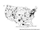
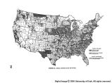
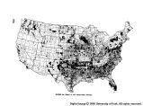
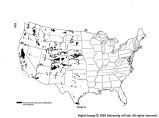
Show normal depletion and growth before and since, combined, served to bring about extreme changes in the forest cover and timber volume. Recommended Standards Both initial surveys and resurveys of the forests need speeding up and intensifying in order adequately to serve many public and private purposes. Maps of natural cover types can serve most purposes best when superimposed upon standard topographic maps as a base. Consequently mapping of these types should follow the preparation of acceptable topographic maps. Units of measurement to serve maximum purposes would have an area of 10 acres in important vegetation types and 20 acres in less important and significant types. All such mapping should be to national uniform standards. Initial surveys to cover some 200 million acres of forest land in the Rocky Mountains, California, Central and Northeastern States are required. In addition, it is de- sirable that resurveys of about 200 million acres covered more than 10 years ago in the Northwest, Lake States, and South, be made as rapidly as possible. Progress on this job has been slow. Available information is also not sufficiently intensive to satisfy commercial demands. More detailed surveys are needed. Contributions from private and State agencies make possible acceleration of survey techniques to meet some local requirements. At the present rate of progress 6 to 8 years will be required to complete the initial survey. And when this is done, resurveys will be far behind. The United States should be covered by a forest in- ventory every 10 years. This means surveying 62 million acres per year. Such surveys could be intensified and adjusted to meet the needs of water resources development. A Nation-wide range inventory, or more properly, a western range inventory, has not been attempted. In- stead various surveys of the range resource have been made, primarily of certain range allotments on public lands rather than for large areas. Perhaps 10 percent of the range area has been mapped and surveyed to deter- mine species, composition and degree of use, but these surveys have not been to the same degree of accuracy or standards. In addition, the separation of range types has not been uniform. Of late, agreement has been reached among many range resource surveyors as to the standards to be sought and the items to be cataloged. The stage is now set for going ahead on a uniform western-wide basis. Recommendation s A complete coverage of the range area is needed. This should be completed in about 15 years with a periodic recheck every 10 years thereafter. Such surveys should encompass all lands, public and private. It is recommended that a cover type map be prepared according to nationally uniform standards and specifi- cations, and that this map should be completed within 5 years of the time that topographic quadrangles for the country are finished. The forest surveys of the United States should be com- pleted within the next 5 years with a new forest inventory on an extensive scale every 10 years thereafter. G. Fish and Wildlife Planning for the full development of our water re- sources requires adequate basic data covering fish and wildlife. They are urgently needed where migratory fish are involved because development can block passage to spawning grounds. They are also needed when planning developments that affect the food and nesting areas of water fowl, especially of migratory birds. They are needed because many water developments may affect the habitat of various game and other forms of wildlife, and in turn the wildlife may affect water developments. They are also needed because quality of water and sedimentation may adversely affect shellfish and crustaceans. These needed data are derived from surveys and from research. Data that are available today are inadequate in many areas to meet the requirements of water resources develop- ment, both in scope and in coverage. Status Stream and lake surveys and the mapping of vege- tation to provide information on habitat conditions suit- able for fish, birds, and mammals, have been made for about 10 percent of the country. Many of these surveys, however, are out of date because changed industrialism, land uses, and water developments have substantially affected conditions. Surveys of important water and land habitat should be made frequently enough to keep current the collection of important facts. Knowledge of fish and wildlife populations and ecology is even less adequate. Detailed information on popu- lation densities and trends for the various fish (including shellfish and crustaceans) and wildlife species, including such things as growth, recruitment, exploitation, and nat- ural mortality rates, has been obtained only rarely and with great difficulty. A very much widened base for com- parison and correlation is essential. A related field of knowledge much in need of rein- forcement concerns fishing and hunting. Generally speak- ing, only approximate estimates can be made of the numbers of people who fish and hunt, either as a livelihood or as recreation, the amount of time they spend fishing and hunting, and their successes. Even less is known of the important and less tangible factors, such as needs and desires of the public which influence participation in this form of recreation. Sound statistical data are needed. Accumulations of the above sorts of fundamental in- formation would have significant usefulness. The limited data now at hand have been used in determining con- servation activities associated with water developments, such as the programs for hatcheries, new shellfish and crustaceans spawning beds, refuges, and wildlife restora- tion. Although many of these measures have been reasonably successful, their efficiency could be increased with more extensive basic data. At the present time, the lack of background data has been a limiting factor in several areas in meeting fish and wildlife requirements in planning water use developments. 363 |


