| Title |
Annual Reports of the Department of the Interior for the Fiscal Year Ending June 30, 1905 (Pt I) |
| Subject |
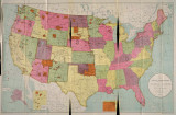
Indian reservations; Federal government; Indians of North America; Maps; Work; Livestock; Food; Indians of North America--Education; Land use; Allotment of land; Treaties; Agriculture; Railroads; Timber; Health; Art; Religion; Indians of North America--Social life and customs; Natural resources; Employment (Economic theory); Horses; Indigenous peoples--North America |
| Keywords |
Annual Report; Indian Agency; Reservations; Resources; Native Americans |
| Publisher |
Digitized by J. Willard Marriott Library, University of Utah |
| Tribe |
Ute |
| Language |
eng |
| Description |
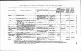
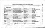
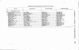
Excerpts concerning Utah from the Annual Report of the Commissioner of Indian Affairs - Courtesy of the University of Wisconsin Digital Collections. The Commissioner of Indian Affairs submits a report describing the need to treat Indians as individuals in federal policy, the need to encourage community involvement on reservations, and the importance of preserving Indian art and culture. The Commissioner also discusses methods of preventing the spread of disease on reservations, distribution of payment for reservation staff, the budget for purchasing goods for use on the reservations, demographic data regarding allotment distribution, and the rate of effectiveness and enrollment in Indian schools. The Commissioner reports that the Uintah Railroad gained the right to cross reservation lands in order to construct rail lines |
| Type |
Text |
| Coverage |
Washington (D.C.) |
| Format |
application/pdf |
| Rights |
Digital Image © 2011 America West Center. All Rights Reserved |
| ARK |
ark:/87278/s6p014cp |
| Creator |
Commissioner of Indian Affairs |
| Date |
1905 |
| Spatial Coverage |
Utah; Washington (D.C.) |
| Setname |
uaida_main |
| ID |
374791 |
| Reference URL |
https://collections.lib.utah.edu/ark:/87278/s6p014cp |


