| OCR Text |
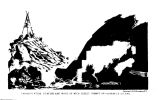
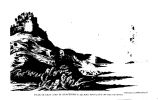
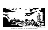
Show VALLEY OF BITTER CRBSK. 285 these animals are now to be seen in the region. The only vegeta tidn, to- day, has been a little dwarf artemisia, grease- bush, rabbit-bush, sah- grass in the narr6w strips of bottom- land, and an occasional dwarf cedar on the bluffs. Appearances indicate that the bed of the stream, which has no banks" above the general level of the bottom, has been completely filled by the spring rains, overflowing the low grounds and carrying down immense quantities of soil, which has been deposited below, upon the broad flats of Green River. The ridges on each side of us to- day have been principally composed- of horizontal gray limestone and disintegrating agglutinated sand^; the escarpments, rounded into^ fantastic forms of bastions, buttresses, and turrets, by the action of the winds and the rains, were in many cases quite beautiful. Day's march, seventeen miles. Lat. 40° 84' 41". 8; long. 109° 28* 9". Sunday, September 15.- Morning slightly cloudy. Ther. at sunrise, 44°. The water being very indifferent, and wood difficult to be obtained, it was determined to make a march to- day te a spring supposed to be about ten miles up the valley. Bitter Creek, at this camp, flbws in a bed twelve feet below the plain of the bottom, and the water in its present stage is about sixty feet wide by six inches in depth. But the accumulation of large piles of flood- wood shows that during the spring freshets, the whole valley, herd about one thousand feet wide, is completely covered with water. The general course of the valley for ten miles was' north, 74° east, over a very- level flat. About halfway of this distance the sand- cliffs disappear, and the valley opens wide, with rounded hills on each side, much less elevated than the bluffs below. At this point the stream forks, one branch coming in from the south, with a wide, level valley. About thirteen miles above, it forks again, both branches heading within two miles of each other, in a small mountain, in which- Red Fork, another affluent of Green River, flowing into it below Brown's Hole, also has its ' sources. One of the guides says that there is a good route by Red Fork to Green River, and thence to the heads of Bear River. A short distance on our left lay a small, shallow lake, some six miles in circumference, formed by the drainage from the hills on the north and east, and very probably by some springs in the vicinity, as the waters appeared clear' and fresh. After passing that point, the hills began to approach each other more closely, and the ascent became rather more abrupt, with numerous gullies, or drains, crossing it at right angles, rendering |


