| OCR Text |
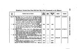
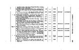
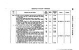
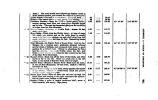
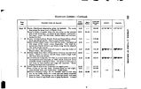
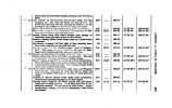
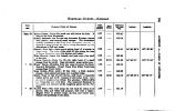
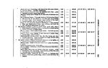
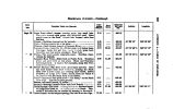
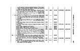
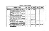
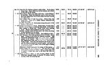
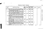
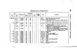
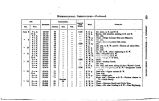
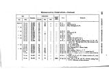
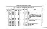
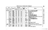
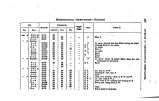
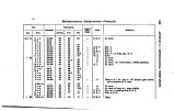
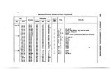
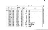
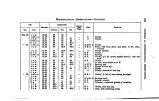
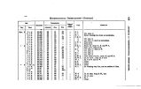
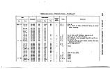
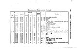
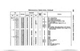
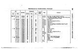
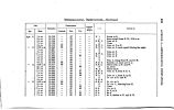
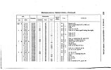
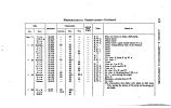
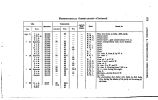
Show 294 APPENDIX A.- DISTANCES TO SAN PBTE. DISTANCES FROM TAB STATE- HOUSE, Oity qfthe Great Salt Lake, to the Settlement in the San Pete Valley, on a branch of Sevier River. Communicated from the San Pete Company* % Journal. Vmamsaatt Poms AHD Gutraro DDZAKCU. To Eanyon Creek Bridge « , " Mill Creek " First Cotton- wood Creek fc " ^ Bishop Crosly's , • « Second Cotton- wood Creek , .-. ,,... " Forks of Road ... .. , " Dry Creek. , " Willow Creek . ...... ^ , , " Hot Springs " Summit of Hill at Jordan Kanyon , " Dry ( Utah) Creek ,..„ , " American Spring , < '. , " American Creek..'. , " Marsh Creek , < , " Cedar Grove ~ , . « « Timpanogas River " Spring Base, of the Mountains * " Spring Creek...,~ - *' Pimquan Creek....,;. '. j " Pequinnetty ( Spanish Fork) Creek. M " Clear Creek. *' Petenete Creek : . " Aph " ........ • « Wa- ka- tiky ( Summit Creek) " Pungun- Ghost Spring .' " Warm Spring Creek........ , " Watage " At 3} miles take left- hand road., " Onsrpah ( Salt) Creek at kanyon , " Kanyon Forks* , " Third Crossing of Ona- pah • « Summit leaving Ona- pah Valley " Pleasant Creek, in San Pete Valley , ". Springs in Slough • « San Pete Creek .". " San Pete Crossing ." Timpa Creek , 44 Mouna Creek M " City Creek, 12 feet wide Totals. NOTI.- The San Pete Settlement was began in 1849, and in 1850 a city was laid out by the Presidency. The distances measured by an Odometer, attached to a wagon. This is on the road to Iron City, in the Little Salt Lake Valley, and the southern road to California. |


