OCR Text |
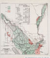
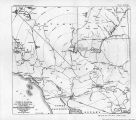
Show PROBLEMS OF IMPERIAL VALLEY AND VICINITY. 75 second from the waters taken from the Colorado River in territory of the United States by the California Development Co., and which, waters this company has ceded to the Sociedad de Riego y Terrenos de la Baja California, S. A. It is also, authorized to carry to the lands of the United States the water, with the exception of that mentioned m the following'article. From the water, mentioned in the foregoing article, enough shall be used to irrigate the lands susceptible of irrigation in Lower California with.vthe water carried through the canal^or canals, without in any case the amount of water used exceeding one-half of the volume of water passing through said canals. (All-American Canal Board report, p. 20.) Storage required.-It is expected that some storage will be required for full development of the lands under the Imperial Canal in California and Mexico. The question of water supply and storage requirements t)f this project must be considered in conjunction with the subject as a whole on the Colorado River, a,nd it is being so considered in the general water-supply report being prepared on the Lower Colorado River in connection with the investigations required under the Kinkaid Act. Present status.-The present constructed works of the Imperial Project are briefly as follows: There is a new heading about 6,000 feet above the old or Hanlon heading, constructed in 1918. This is a concrete structure, with ife face parallel to the river bank. It consists of 75 gates 8 feet center to center, 27 of which have a sill elevation of 98>.6 feet above sea level and 48 have a sill elevation of 106.7 feet. The height of the structure above the higher sill gates is 21 feet. The piers are 18 inches thick, and there is a 24-foot pier between the high and the low sill gates. The main canal from the Rockwood heading through Mexico is about 55 miles long and mainly follows an old channel of the river known as Alamo River. Portions of the channel have been straightened by constructing cut-offs, and these portions especially will require enlarging for the carrying of sufficient water for the entire project/ Also the old channel, due to silting, has in places spread out over considerable areas and will require dredging or reconstruction for full development of the project. The maximum amount carried in the canal to date has been about 6,00Q second feet. There are about 70 miles of distributaries operated by the district in Mexico and about 61 miles constructed and operated by the district in the United States. Other distributing canals and laterals in the United States were built, and are operated by 14 separate water companies, the distributaries of these companies aggregating approximately 2,300 miles in length. The total canals and laterals of the Imperial project in both California and Mexico aggregate approximately 2,570 miles. The distribution system of the project is estimated to be 75 per cent completed. The area irrigated in the Imperial district in 1920 was 415,000 acres, or 80 per cent of the net irrigable area, and in Mexico there were irrigated, in 1920, 190,000 acres, or 75 per cent of the net irrigable area. Levees constructed.-C D. Co. and Saiz Levee, built by C. D. Co., 1906 to 1909, length 27 miles, with 10 miles enrocked. Volcano Lake levee, built by C. D. Co. and United States, 1908 te 1912, and later raised 3£ feet and extended to connect with the Inter-California Railroad and with the bank of the main Imperial Canal, length 18 miles, with 8 miles enrocked. |
Source |
Original book: [State of Arizona, complainant v. State of California, Palo Verde Irrigation District, Coachella Valley County Water District, Metropolitan Water District of Southern California, City of Los Angeles, California, City of San Diego, California, and County of San Diego, California, defendants, United States of America, State of Nevada, State of New Mexico, State of Utah, interveners] : |