OCR Text |
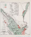
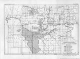
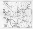
Show 56 PROBLEMS OF IMPERIAL VALLEY AND VICINITY. The valley is 25 miles in length with an average width of about 6 miles. It lies in a compact body and is well adapted to irrigation development. The river skirts the east side of the valley except near the north end, where the Palo Verde Valley overlaps the rarker Valley; and at the south end, where it overlaps the Cibola Valley. These three valleys in fact constitute one large valley, being broken only by the river channel at the two points where it crosses the valley. The Palo Verde mesa lies adjacent to and west of the valley and the Chucawalla Valley lies west of this,>over a small divide. The general elevation of the valley is 250 feet above sea level. The engineer in charge of the project, Mr. C, E. Yost, states-that it will overflow with a flood of from 50,000 to 60,000 second-feet without levies, and that bank protection would be necessary with a flood of 35,000 second-feet. There is a rock point on the west river bank at the head of the Valley known as Blythe Heading, which is the point where the main canal diverts. The river strikes the west bank about this rock point, which diverts it to the east bank across the valley. The river has always hugged this rock, though there is no natural barrier on the east bank to prevent the river from leaving the heading and going to tne east. HISTORICAL. About the year 1856 * * * Thomas H. Blythe came into the Palo Verde Valley and acquired about 40,000 acres under the swamp and overflow act. TMs tract became known as the Blythe rancho. Blythe then proceeded to make certain water 'filings^ * * * He built the gravity intake now in use, and known as Blythe intake, a main canal and laterals, and irrigated a considerable area. In 1905 or 1906 a corporation known as the Palo Verde Land & Water Co. was organized and acquired the Blythe rancho and all the water rights appertaining thereto. TMb corporation imme-. diately proceeded to repair, enlarge, and extend the irrigation system, and to develop and colonize the rancho. In 1908 the present company was organized in the valley and bought all of the water right filings from the Palo Verde Land & Water Co., together with all the rights of way for the canal system extensions. The present company is a mutual one, each farmer taking water from the canal system being a shareholder. It is called the Palo Verde Mutual Water Co., and has operated and extended the canal and levee systems. This company also attended to the perfecting of the water rights. In 1918 the Palo Verde joint levee district was organized for the purpose that its name implies. This organization is separate from the water company, though at the present time there are three men who hold the position of director in both companies. For a time the management of the two companies was separate, but at the present time it is all handled in the office of the water company, and is under the direction of one engineer, Mr. C. E. Yost. LAND. lopography and soils.-The valley is flat river-bottom land, all subject to overflow without protection. It is generally quite smooth and free from small sloughs as compared with other valleys along the Colorado, though there are a few large sloughs extending through the tract. As is characteristic of the valleys of the Colorado, it is lowest on the farthest side from the river or near the mesa, the fall being about 15 feet. The lower end of the valley is a fine, rather heavy silt. The middle and upper portion is a light sandy silt. The soil is very fertile, as |
Source |
Original book: [State of Arizona, complainant v. State of California, Palo Verde Irrigation District, Coachella Valley County Water District, Metropolitan Water District of Southern California, City of Los Angeles, California, City of San Diego, California, and County of San Diego, California, defendants, United States of America, State of Nevada, State of New Mexico, State of Utah, interveners] : |