| OCR Text |
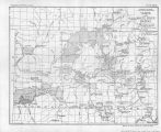
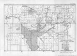
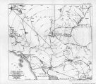
Show PROBLEMS OF IMPERIAL VALLEY AND VICINITY. SEEDSKADEE PROJECT. The Small and" Large Seedskadee can be covered by the same canal, and hence are described together. Precipitation, 6.5 inches. Temperature, 42°. Between frosts (summer), 85 days. Transportation, 10 to 30 mile hauls to stations on the Union Pacific. Irrigation plan.--Diversion from Green River on west bank 2 miles above mouth of La Barge Creek. Thence skirting the river abqut 30 miles to the project, picking up creeks en route. About 5 miles is rough going which must be flumed. Some stretches of canal must be lined and there are two siphons crossing creeks. Discussion as to other items concerning the project is in the general discussion preceding, which shows that water supply is sufficient if reservoirs are feasible, and that after fche irrigable acreage has been determined it remains only to determine how many of the reservoirs at headwaters are necessary. GREEN RIVER PROJECT. Statistics are the same as for'the Seedskadee. It is on the opposite side of the river and is segregated under Carey Act list No. 49. It is said to be a very smooth body of land with shallow soil. Diversion can be accomplished by heading on west side of river on Anderson Island, Section 20, township 25 north, range 112 west; thence about 15 miles along river to a siphon crossing to east side in section 25r township 24 north, range 112 west; thence about 3 miles to main; body of land. Taking the Green River project by itself, ,the average estimated supply, as compared to demand, is as follows: Supply. Demand. Aug.2O-Mayl5. May 15-31....... June............ July............ Aug. 1-20....... Acre-feet. 100,000 ¦ 99,000 286,000 109,000 12,000 Acre-feet. 24,000 86,000 86,000* 38,000- That is, storage at any one of the lakes is practically sufficient for the average year, but/for dry years like 1919 storage sufficient for all of July and August and part of June is required to give a full supply, or about 170,000 acre-feet. BONNEVILLE PROJECT. Irrigation plan.-Diversion from Green River in section 14, township 28 north, range 11 east, thence to New Fork River across much-side drainage for 16 miles to a tributary of New Fork River. Diverts from New Fork River in section 11 and township 34 north, range 110 west, thence by canal 62 miles long to Big Sandy Creek. Of this, 38 miles should be lined because in glacial material. The line contains, five tunnels, one siphon, and eight flumes. |
| Source |
Original book: [State of Arizona, complainant v. State of California, Palo Verde Irrigation District, Coachella Valley County Water District, Metropolitan Water District of Southern California, City of Los Angeles, California, City of San Diego, California, and County of San Diego, California, defendants, United States of America, State of Nevada, State of New Mexico, State of Utah, interveners] : |


