| OCR Text |
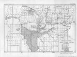
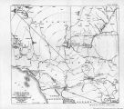
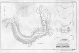
Show 58 PROBLEMS OF ntfPKRTAT, VALLEY AND VICINITY. At 7$ miles below the intake are located the controlling gates of the three submains, at the lower end of the main canal proper. The engineer in charge, Mr. Yost, states that the canals are sufficient in capacity for the irrigation of the entire valley on condition of proper cleaning. The main levee as constructed at present extends from the head of the valley to the county line near the lower e*nd of the valley, a length of 28£ miles. The section of the levee is: Crown 12 feet, river slope 3:1, land slope 2:1, average height 10 feet. A borrow pit has been constructed continuously on the land side, with a berm of 50 feet between* the pit and the levee. This borrow pit is intended as a shallow drain and has been fairly successful for this purpose, though deep drains are planned some distance back from the levee; 3,500 feet only of the levee have been riprapped. Two miles^of railroad are constructed on the levee and 3 miles leading from, the levee to the quarry. There are several cross levees extending from the main levee out into the valley. The area protected by levees at present is said by the engineer in charge to be 70,000 acres,, which is also the area under the present constructed canal system. The area irrigated hi the present season (1920) is approximately 35,000 acres. The shares of water stock issued by the company represent water sufficient for 1 acre to the share. To the present date, October 20, 1920, 40,700 shares have been sold. These shares are valued at $35 per share. IRRIGATION PLAN. The Palo Verde project is entirely a gravity system. The water is diyerted direct from the river at the Blythe intake, as above described, without a diversion dam. There is no plan on the part of the management for the construction of a dam at this point, first, for the reason that it is not needed, as at practically all times there is sufficient head against the intake for the required diversion, and in the second place for the reason that there is no dam site at the head of the Palo Verde Valley. As stated previously, there is no physical reason "why the river should not leave the Blythe heading and go to the east, as there is a wide., flat valley at this point. This, however, has never occurred in the history of the project, though it does .not necessarily follow that it will not occur in the future. Such a possibility is realized by the present management, and plans are made to riprap the opposite bank in case it should become necessary. Tne aesilting question is handled fairly well at the present time, considering that there is. no diversion dam with sluiceway, as at Laguna. This is probablyrthe best natural intake on the lower Colorado River, ana the project is thus fortunate in being able to enjor the benefit of reasonably well desilted water without the cost of diversion dam. The lateral system is now constructed for all but about 9,000 acres in the valley, and the present plan is to extend these laterals as water stock is purchased by new lands and water is called for. The sale of the stock pays for the construction of the new laterals. It is planned to extend the main levee to the lower end of the valley for a distance of 6 miles. A railroad is planned to be constructed on |
| Source |
Original book: [State of Arizona, complainant v. State of California, Palo Verde Irrigation District, Coachella Valley County Water District, Metropolitan Water District of Southern California, City of Los Angeles, California, City of San Diego, California, and County of San Diego, California, defendants, United States of America, State of Nevada, State of New Mexico, State of Utah, interveners] : |


