| OCR Text |
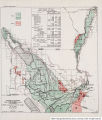
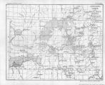
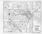
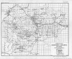
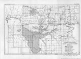
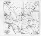
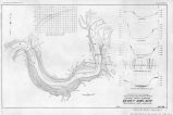
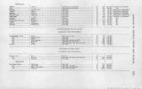
Show VI CONTENTS. PHOTOGRAPHS, DRAWINGS, AND MAPS. Page. Plate I. Relief map, Colorado River Basin............................... vm 11. Capacity and area curves, Boulder Canyon Reservoir.............. 20 III. Capacity and area curves, Black Canyon Reservoir................ 20 IV. Boulder Canyon, view of "C " Dam site......................... 20 V. Map, Lower Colorado River Basin.............................. 20 VI. Firm horsepower at Boulder Canyon Dam site................... 20 VII' Topography and profiles, Boulder Canyon Dam sites.............. 28 VIII. River Bed Section, "A" Dam site, Boulder Canyon Reservoir___ 28 IX. River Bed Section, "C" Dam site, Line C-l, Boulder Canyon Reservoir................................................... 28 X. River Bed Section, "C" Dam site, Line C-2, Boulder Canyon Reservoir................................................... 28 XI. Preliminary design curved gravity dam, Boulder Canyon Reservoir ___.................................................... 28 XII. Operation of Boulder Canyon Reservoir to provide 700,000 horsepower....................................................... 30 XII-A. Operation of Boulder Canyon Reservoir to provide 600,000 horsepower....................................................... 30 XIII. Map. Cottonwood Island. Nevada-Arizona....................... 48 XIV. Map, Mohave Valley project, Arizona............................ 50 XV. Map, Parker project, Colorado River Indian Reservation.......... 52 XVI. Map. Palo Verde Valley project (Blythe), Calif.................. 54 XVII. Map, Palo Verde Mesa and Chucawalla Valley project, Calif___•.. 58 XVIII. Map, proposed irrigation system, Cibola Valley. Ariz............. 60 XIX. Map, irrigable area below "Laguna Dam.......................... 62 XX. Map, Yuma project, Arizona-California.......................... 64 XXI. Map. preliminary surveys. Imperial Valley....................... 98 XXII. Map, Green River Basin. Wyo".................................. 102 XXIII. Map, Yampa and White River Basins........................... 116 XXIV. Map, Uinta Basin. Utah........................................ 132 XXV. Map, Grand River Basin. Colo.................................. 138 XXVI. Map, Gunnison and Dolores Rivers, Grand Rive*- Basin. Colo..... 144 XXVII. Map, San Juan River Basin..................................... 158 XXVIII. Map, Price River project, Utah................................. 168 XX iX. Map, Dixie project. It ah-Arizona............................... 168 XXX. Map, Little < 'olorado River project............................. 168 XXXI. Map, Green River project....................................... 172 XXXII. Map, diversions from Colorado River to Mississippi River Basin. .. 176 • XXXIII. Map. Boulder < 'an yon Reservoir she and surrounding territory...... 178 XXXIV. Map' Colorado River Basin.................................... 184 XXXV. Approximale profile of Colorado and Green Rivers............... -186 XXXVI. Topography and profiles, Dewey Dam site....................... 188 XXXVII. Topography and profiles, Flaming Gorge Dam site............... 188 XXXVIII. Topography and profiles. Juniper Dam site....................... 1S8 XXXIX. Section and curve, Browns Park Dam site, Green River.......... 188 XL. Section and curve, Ouray Dam site, Green River................ 188 XLI. Section and curve, Upper Hear Dam site, Bear River............. 188 XLII. Section and curve, Rangely Dam site, White River............... 188 XLIII. Section and curve, Starvation Dam gate, Strawberry River........ 188 XL-IV. Section and curve, Kremmling Dam site, Grand River............ 188 XLV. Section and curve, Turley Dam sile, Pan Juan River............ 188 XLVI. Section and curve, Bluff Dam site, San Juan River.............. 188 XLVII. Section and curve, Junction Dam site, Colorado River........... 188 XLVI IT. Section and curve, Bulls Head Dam site, Colorado River......... 188 XL1X. Map, All-American Canal....................................... 188 L. Profile, All-American Canal, Laguna Dam to West Side Main .... 188 LT. Laguna Dam, proposed changes................................ 188 LI I. Typical section, All-American Canal, south end of Sand Hills. . .. 188 |


