| OCR Text |
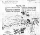
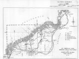
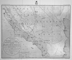
Show 334 REPORT OF THE CHIEF OF ENGINEERS. nardino Range, flows across the valley, and disappears in the saud near the base of the San Jaciuto Peak. Green " gallete" grass wo* found in the washes near Mule Spring Station. These washes also contain a plentiful supply of mosquito trees and a few willows. At Dos I'alnms there is a little salt grass. Los Torros and Martinez are fertile spots in the desert. Here the water rises near the surface and the soil remains moist the whole year, hence vegetation flourishes and the ground is eminently fit for cultivation. At these places and at Agua Calicute are found numerous Indian rancherias, occupied by the Coahuila Indians. These Indians cultivate small garden-plats and raise some grain and vegetables. The temperature was high when we passed through the valley, and in the lower portions of it the heat was excessive, being about the same as had been experienced on the Colorado River, although it was now the latter part of September. The atmosphere was alho very dry, and the same hot, desiccating winds were encountered here. Portions of this valley bear unmistakable evidence of having been covered with water. The beach-line is very distinct just before reaching Dos Pal mas, and also in the vicinity of Los 'forms. Great quantities of shells are seen in a good state of preservation near this beach-line, which would seem to indicate that the time the lake existed was not very remote. After attaining the first summit from Ehrenberg a valley of considerable extent is seen to the west, which apparently has no outlet. This basin is not as low as that ot* the Coahuila Valley. (On passing this summit on my second trip I ascended a high peak near the road. The view obtained from that point leads me to believe that the valley referred to has a drainage to the river through a wide wash several miles above the Lagura.) SECOND EXPEDITION. By letter of instructions dated United States Engineer Office, Geographical .Surveys West of the One Hundredth Meridian, Washington, D. C, January 19, H?<>, I was directed to organize a party and proceed to Ehrenberg, on the Colorado River, thence down the western bank to the boundary, for the purpose of continuing the investigation as to the feasibility of the diversion of the river for pur|M>ses of irrigation, and also to determine, if practicable, the approximate area of the depression below the level of the sea. The middle route, via Temecula, was specified as the inward route from Fort Yuuia to Los Angeles. ORGANIZATION. The party was organized as follows: 1 executive oflicer and field astronomer; 1 toi»ogrnpher; 1 assistant topographer; 1 meteorologist; 1 odometer recorder; 2 packers; 1 cook; 1 teamster; 2 enlisted men. Total, 11. Means of transportation were: 10 riding-mules; 7 pack-mules; 3 extra mules; C team-mules. Total, 5tti. Ono enlisted man, Sergeant Eugene Farnliain, Company G, Twelfth Infantry, wu left at Los Angeles as barometer observer during my absence. I will take occasion to remark here that he performed his specified duties to my entire satisfaction, recording the observations carefully and accurately. DESCRIPTION OF ROUTE. From Lot Angehu City to Ehrenberg, ('amp 14.-The party left Los Angeles February 13, and reached the Colorado Kiver opposite Ehrenberg, Ariz., March 3. The outward route was the same as the inward route of last trip. Several changes had taken place since.we previously passed over it. The Southern Pacific Kailroad was now finished as far as Whitewater Station, and the grading completed to a point opposite Indian Wells. Two stage-lines were running from the terminus of the railroad to Ehrenberg, and thence through Arizona and New Mexico. Consequently the stations had been fitted up and wells and springs cleaned out, so that the supply of water was abundant. A few new wells had been dug and stations established by the new stage-line, (Wells's Express Company,) as at a point about half-way between Torros and Dos Palmas, and another 6 miles east of Mule Spring Station. A well was being dug on the Chuckawalla Bench, between Canon Springs and Chuckawalla, with but little chance of striking water. The country appeared rather more sterile and forbidding than before, as the mes-quite trees had lost their leaves, and not a spear of green grass was to be seen between Whitewater and Ehrenberg. The temperature was. however, tolerably cool during day, and the nights were sometimes quite cold. Ice formed during the night at Whitewater, Chuckawalla, and one night at Ehrenberg. The day we went from Canon Springs to Chuckawalla we had a drizzling rain, and this was accompanied by a cold, piercing wind on the high mesa near (he divide. At Ehrenberg the river was found to be about 2 feet lower than it wus at the time of our first visit. A long sand-bar was exposed lietween the ferry-land ings, which rendered it necessary to tow the ferry-boat half a mile up stream*before a crossing could be effected. |


