| OCR Text |
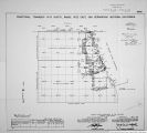
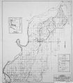
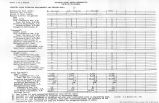
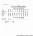
Show Boundary of Port Mohave Indian Reservation (Formerly Camp Mohave Indian Reservation) chains 42.26 ".2.26 108.26 Retracement for Resurvey.continued. Frac.T.l8 K. ,R.22 W.,G.* S.R. B.A M. .Ariz. Set stake and continue line and measurement. Record dist.) No trace of 9 mile mon. Set stake and continue line and measurement. Record dist.) No trace of 9? mile mon. Set stake and continue line and measurement. Record dist.) No trace of SW. Cor.of-C.H.I.R. Bdy. and meander cor.of sec.21, ?rac.T.l8 U..R.22 W..G.* S.R. B.& M..Ariz. Set stake and discontinue "Retracement for Resurvey" Retracement of the remainder of the south line (2-3) of the bdy. of old Hay and Wood Reserv.,on its record course across Colo. Hirer as hereinafter described, fails to locate Cor.No.5 thereof, therefore the random line run from the 8 mile non.of C.M.I.R. Bdy. us here-inbafore described,becomes the true line for reeurvey of F.H.I.R. Bdy.,and the stakes set at the record distances thereon mark the points for reeatabliahment of all missing cors. and monuments, thus restoring the record of the Fisher survey bet.the 8 and 9i" mile mons Retracement for Survey. From stake sot at recorded point of locution of the SW. Cor. of O.H.I.R. Bdy. (108.26 cha. 3.76°17«28"W. from temp.5K.cor.of same Bdy.) aa hereinbefore described, S.76°i7' 2B"'.¥. (record course) on random line,on continuation of south line(2-3) of old Hay and Wood Reserv. i4.JOk4O.OU cha. S.76°17'28"W. from temp.9s- mile mon.) Set stake for tamp. 10 mile mon. and continue line and measurement. 1^.50 TrianpruLation point "A" on east or left.bank of Colo. River. 13.75 3est or left ed*e of water in Colo.River. Discontinue chaining and measure random line across the river by trianrulitlon us follows: 60.25 64.25 64-75 12U.24 Set flag "B" ahead on random line,on sand bar near west edge of water surface of Colo.River. 3et flag "C" at point near west ed^e of water and bearing 11.73*37' ZO"W, from triang. point "«". Bearing bet, flags "B" and "C" is H.23'49'W..and the chained distance is 2?.40 chs., which is used as a Base for this triangulation. A.LI bearings checked by direct re&dinps of the solar, and all angles checked by deflection. Dist.on random line to "A" ¦ 18.50 che. Dist. A-B by triangulation - 41.^5 ¦ Dist. on random line to nB" " 6O.25 chs. from the recorded point of location of SW.Cor. of CM. I. H. 3dy..or 168.51 chs. S.76°17'28"W. from the temp. S3.Cor.of asiie bdy. Triang. flag point nB",on sand bar,near west edge of water surface of Colo. River. Continue line and measurement by chaining. Foot of west or right bank of Colo. River,25 ft. high, bearing MV7. and 32. Top of same bank, and east edge of nesa. Whence across mesa. (Record dint, of 228.50 chs. S.76°17'28"W. from Cor.No.2 of old Hay and Wood Reserv.) Diligent search in this vicinity falls to reveal any trace of Cor.No.^ of old Hay and Wood Reserv..however, since this T>olnt is on the mesa at a considerable (list, beyond the w«st bank of the river, and at |
| Source |
Original book: [State of Arizona, complainant v. State of California, Palo Verde Irrigation District, Coachella Valley County Water District, Metropolitan Water District of Southern California, City of Los Angeles, California, City of San Diego, California, and County of San Diego, California, defendants, United States of America, State of Nevada, State of New Mexico, State of Utah, interveners] : |


