| OCR Text |
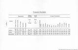
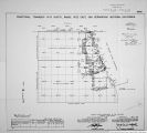
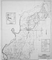
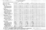
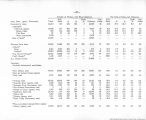
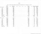
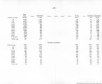
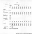
Show Boundary of Fort Mohave Indian Reservation ( formerly Camp Mohavo Indian Resorvatlon) chains 16.00 48.30 56.00 24.02 1.88 40.06 40.22 Thence northeasterly on UW.line (^-4) of old Mil.P.esr>rv. to point for Cor.No.4 thereof,now designated and monument ed as Cor.No.9 of Bdy. of F.M.I.p.. Thence southeasterly on NE.line (4-U of old Mil.R«H«rv. to Initial Mon. of Camp Mohave Indian Reserv.,novi designated and monumented aa Initial Mon. of Bdy.of F.M.I.P The polnts for Core.Nos.3 and 7 of Bdy.of P.M.I.P.. fall in the water of the Colo. River. Cor. Wo.3 is witness ed by a monument on line 2-3 of Bald bdy.near east ban of river, Point for Cor.Wo.7 is too far dlstant from an accessible point on land to permit of the establish ment of a witness cor. thereto. in the survey of the completion.of the Bdy. of F.M.I.H. hereinafter described, mile and half-mile monuments are establiahed,alternately, at 40 ch. intervals,count ing from the reestablished 9t mile mon. except where surface conditions at such mile or half-mile point either cause the establishment of a witness cor., or the omission of both monument and witness oor.thereto. Retracement for Resurvey. From as. Cor. of Camp Mohave Indian Reservation, established by Fisher in 1905 at restored point for cor.5o. 1 of the old Camp Mojave Mil. Reserv., J.5fc)°51'52"W.,(record course) on random line, along ME. Line (4-1) of Bdy.of old Mil.Reserv. ,and on 1st mile) of the Camp Mohave Indian Reserv. Bdy. Record dist. Intersect the mile mon.of Bdy.of CM. I.H Continue line and measurement Fall 8 lies. N.0° 2'W. of closing cor.of secs.9 and 10, frac.T.19 IK.R.22V/., 0.* S.R. .B.4 U.,Ariz. Continue line and measurement. Reoord dist.) Intersect the east or left bank of the Colo. River. Dilirent aearch in this vicinity i'aiis to rer»al any truce of the Initial Mon. of Bdy. of Camp liohave Indian Keaerv. Set stake for temp. I.M. ?rom HE.Oor. of C.U.I.R. S.OC38' 6"W.,(reoord pouree)on random line,on part of 2nd half of 1st mile of C.U.I.R. Bdy. Fall 2 lies. W. of 1 mile mon. True oo.urte and di«t. of the portion of the 2nd half of the 1st mile of C.U.I.Hi Bdy. bet. HE.Cor. and 1 mile mon. are therefore, 3.0o35»14"W., 24.u2 ohs.,and the total length el 2nd half of let mile is 40.02 chs. 8.0*58' 6"W.,(reoord ooursej on random line,on 1st half of 2nd mile of C.U.I.R. Bdy. Record diat.l 9*11 8 Iks. w. of olosing cor.of aecf.10 •nd 15, Frao.T.19 1J.-.B.22 'V.,C* S.R. B.A H.,:.rl«. Continue line and raeahureoent Pall ZU Iks. w. of If mils non. True oourse and diat. of 1st half of 2nd mile of C.M.I. 3. Bdy. are therefore, 3.0*17' 3nW.,4O.O6 chs., and the closing oor. is 7 Iks- 8. of true line. From 4a mile mon. on C.H.I.R. Bdy., 3.OM8' b"W., (record course) on random line,on 2nd half of 5th mile of C.H.I.R. Bdy. Fall 3t Iks. \1. of original point of location of the 5 mils mon. True, course and dist, of 2nd half of 5th miie of O.U.I. R. Bdy. are therefore, 8.0*33' 6" W.,40.22 chs. |
| Source |
Original book: [State of Arizona, complainant v. State of California, Palo Verde Irrigation District, Coachella Valley County Water District, Metropolitan Water District of Southern California, City of Los Angeles, California, City of San Diego, California, and County of San Diego, California, defendants, United States of America, State of Nevada, State of New Mexico, State of Utah, interveners] : |


