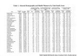
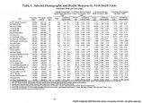
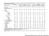
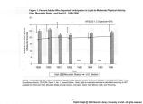
OCR Text |
Show data can be compared to information on environmental exposures; survey data on risk factors can be compared to information on hospitalizations, and so forth. In this paper, methods to specify small areas in Utah are described and discussed. The small areas that are specified by these methods are then used to examine health status in Utah. Four health measures were selected as examples because they represented variables from a variety of data sources that yielded geographic differences: Motor vehicle crash death rates, percentages of persons without health insurance, percentages of women giving birth who did not have early prenatal care, and percentages of adults who smoked cigarettes. Several issues surrounding the design and use of small areas are also discussed. Methods A variety of methods exist for aggregating persons into discrete geographic units below the state level. Public administrators often use counties, or groups of counties such as local health districts. Although county-level data are often available, such analyses do not provide sufficient geographic detail in urban counties with large population sizes. Perhaps the smallest widely-used geographic units are the U.S. Bureau of the Census' block groups, areas of only a few blocks used by the Census Bureau to enumerate the population. Census block groups are aggregated into census tracts which are designed to contain relatively homogenous populations of similar sizes. Neither block groups nor census tracts can be used in Utah because health data such as vital records, hospital data, and health surveys are not identified by census block group or tract. ZIP code areas were used to define small areas in the current study because they are the smallest commonly-used geographic units that are also identified in most health data sources. ZIP code areas are discrete geographic areas used by the U.S. Postal Service in mail delivery that often roughly follow political boundaries. In some sparsely populated areas, counties were used as the geographic unit of interest. Population size criteria for designing the small areas in this study were determined based on health event incidence rates. Smaller areas may be more meaningful to communities, but rates based on small numerators are unstable (Buescher, 1997) and confidence intervals for such rates are large, rendering the comparisons uninterpretable for most practical purposes. Using such small areas with small numbers of events may also pose privacy problems for more sensitive events, such as suicide or AIDS. The population size criteria were determined by examining the three- and five-year incidences of selected events, such as infant mortality and lung cancer, for which small area estimates were desired. A numerator of 20 or greater produces relatively stable estimates, and also approximates a normal distribution of the Poisson parameter (u), which simplifies computation of confidence intervals (Ahlbom, 1993). It was determined that areas with 40,000 to 60,000 persons would produce incidence counts of 20 or more for a wide range of health events. Increasing the population sizes sufficiently to produce reliable estimates for rare events (e.g., homicide or AIDS) would increase area size beyond that which would allow meaningful community level analyses. Where possible, areas with 40,000 to 60,000 persons were established, but areas with population sizes of approximately 20,000 were created when low population density, community identity, or others factors suggested that it was appropriate. ZIP codes and counties were used individually or combined to create 61 geographic areas. Because the local health district is the primary seat of community public health decision-making in Utah, areas were geographically constrained so that their boundaries would not cross local health district boundaries. Most multi-county Utah health districts contain more than one small area. In all but two cases, only contiguous ZIP codes were combined. With only one exception, sub-county small areas were wholly contained within individual counties and were not combined with ZIP code areas in neighboring counties. Whenever possible, the areas were designed to conform to established political boundaries of cities and towns. We examined the median per capita annual income levels of each ZIP code area to guard against combining ZIP code areas with extremely divergent socio-economic status. After addressing the criteria listed above, there still remained areas whose boundaries had not been set. For those areas (primarily the urban counties that were subdivided into many small areas), ZIP codes were combined based on the authors' and their colleagues' perceptions of the similarity of the populations. The resulting draft small area design was then submitted to local representatives, primarily in areas where subjective criteria had been used to combine ZIP code areas. The local representatives (10 of the 12 Utah local health officers, and 26 city officials selected from the directory of the Utah League of Cities and Towns) 19 |