| OCR Text |
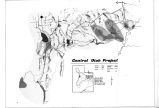
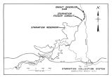
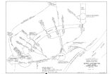
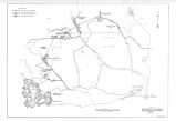
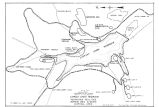
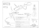
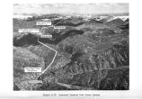
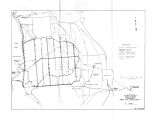
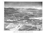
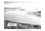
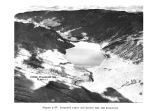
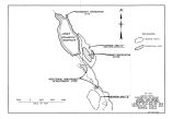
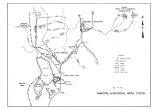
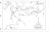
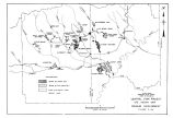
Show Hobble Creek Diversion Dam Hobble Creek Diversion Dam would divert a major part of the high runoff flows of Hobble Creek to Springville Bypass for conveyance around Springville to Provo Bay Bypass. The damsite and settling basin would be located on Hobble Creek in Utah Valley near the west base of the mountains about 1^ miles downstream or west from the mouth of Hobble Creek Canyon. The 1,800- acre- foot settling basin would settle debris and silt from the diverted flood waters. The site is reached by a paved county road running south from Hobble Creek Canyon Road, about 1 mile southeast of Springville. The dam would consist of a dike structure and headworks. The dike structure would have a crest width of 20 feet, a crest length of about 2,200 feet, and a maximum height of about 12 feet. One headworks would control flows into Hobble Creek; and a second would consist of a rectangular concrete section to convey the flow, a radial gate to control the flow, and a Parshall flume to measure the flow. Impervious embankment materials for the diversion dam would be available in the vicinity of the damsite. However, no borrow areas have been outlined at the present time. Springville Bypass Springville Bypass would consist of an open concrete chute from its beginning to a point where it would leave the benchlands near Springville and a gravel- lined canal for the remainder. The bypass would begin at Hobble Creek Diversion Dam and traverse westerly along the floor and the south side of Hobble Creek Valley. It would then run along the south side of the large Hobble Creek delta, passing to the south of the Springville area to its confluence with Provo Bay Bypass. The Springville Bypass would convey flood flows from Hobble Creek in excess of 600 c. f. s. around Springville. On the average, it would be used about once in 10 years. Provo Bay Bypass Provo Bay Bypass would begin along Hobble Creek about 1 mile northwest of Springville. The bypass would 86 |


