| OCR Text |
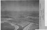
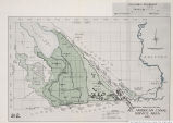
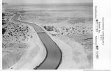
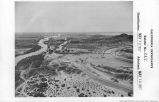
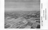
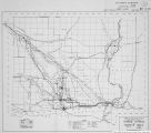
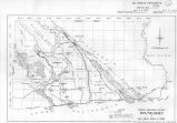
Show BOULDER CANYON PROJECT 17 These levees have been raised and extended until further or better protection by that means is virtually impossible. The dam here authorized with the consequent large storage will permit of the regulation and stabilization of the river 'a flow and completely solve the flood danger. Unless prompt action is taken, any year may witness a flood of very serious and possibly disastrous consequences. PHYSICAL CONDITIONS Mr. F. E. Weymouth, formerly chief engineer of the Reclamation Service, in his 1924 report recommending the project, stated in the plain and conservative language of the engineer, the physical conditions causing the acute flood menace which exists: In its present state of partial development, however, the river is a menace no less than it is a benefit. Each spring the snows accumulated on the mountain slopes of the upper basin melt with the advancing season until by the end of May the lower river has become a raging torrent. This flood usually reaches its peak in May or June, after which it ordinarily subsides; the floods have been known to continue into August. Annually the river carries past Yuma an average of 200,000,000 tons of silt. When the river is not in flood, this silt burden is largely carried to the Gulf, but in times of flood when the river spreads beyond its banks, it drops its load of silt not only at its mouth but wherever along its course the velocity of the water is checked. Especially does this deposition of material occur along and near the banks of its low water channel. These banks are thus built up by successive floods until they hold the waters to such an elevation that the main current of the stream eventually breaks through and finds a new channel in lower ground. In the delta region below Yuma, being less restricted by natural lateral barriers, this tendency finds widest scope. Here the river has built a conical fan-shaped ridge cutting off what formerly was the upper end of the Gulf of California. Along the crest of this flat delta ridge runs the river; one slope toward the south terminates at sea level at the present head of the Gulf of California, the other extending northerly on a much steeper slope reaches a depression 250 feet below sea level at the rim of the Salton Sea. The portion of the ancient gulf thus cut off constitutes the Salton Basin, the irrigated area of which, lying largely below sea level along the northward delta slope, is known as Imperial Valley. Again referring to temporary means adopted by Imperial irrigation district for flood protection the report proceeds: Within a few years at the most the silt deposits will raise the elevation of this latter area to a point where the main current of the floods will again be thrown to the west and north, at which time the assaults of the river on the Volcano Lake levee will be renewed, with assurance that sooner or later another break into the valley will occur. The menace in case of such a break is not limited as at Yuma and above to the loss of crops and improvements and the cutting away of a few or many acres of valuable land, serious as that menace is. Besides all this, the greater danger here is that the levee once breached and the river at flood turned into Salton Sea, the steep gradient of its course will induce the cutting through the soft alluvial soil of a gorge in which the flow may not be checked until a large part of the valley has become submerged beneath the waters of an inland sea. (Hearings on H. R. 2003, 68th Cong., 1st sess., pp. 711, 712.) It should further be pointed out that, in addition to destroying crops and damaging lands, the Imperial Valley has the decided disadvantage of being below sea level and having no outlet for the water. Ordinarily, the flood waters from any stream finds its way back into the stream as the flood subsides. This is not the case in Imperial Valley There the flood waters remain in the basin until taken out by the slow process of evaporation. S. Rept. 592, 70-1-----2 |
| Source |
Original book: [State of Arizona, complainant v. State of California, Palo Verde Irrigation District, Coachella Valley County Water District, Metropolitan Water District of Southern California, City of Los Angeles, California, City of San Diego, California, and County of San Diego, California, defendants, United States of America, State of Nevada, State of New Mexico, State of Utah, interveners] : California exhibits. |


