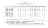
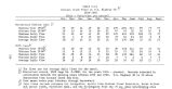
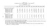
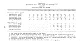
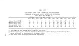
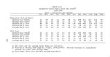
| OCR Text |
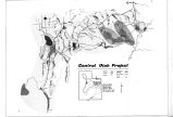
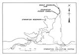
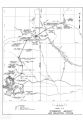
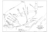
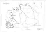
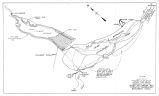
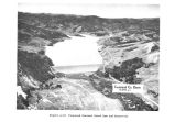
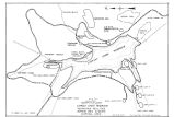
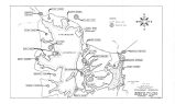
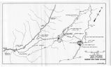
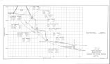
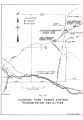
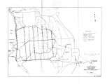
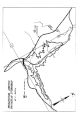
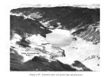
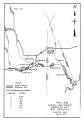
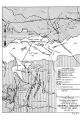
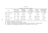
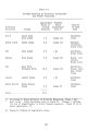
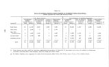
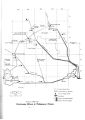
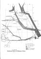
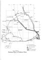
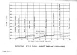
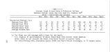
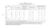
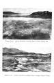
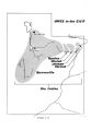
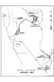
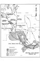
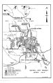
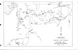
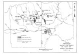
Show under Unit conditions. Minimum recorded flow at the gage has been 1.8 c. f. s. The proposed combined annual diversion of both streams has been estimated to be 4,800 acre- feet. An estimated 200- acre- foot bypass to downstream rights would be made and 400 acre- feet would be spilled during the high runoff period. The U. S. Forest Service has recommended a minimum 3- c. f. s. bypass for a fishery on Wolf Creek to maintain the Class III fish habitat. This recommended minimum flow was not incorporated into the plan; therefore, a loss of aquatic habitat would occur. Seepages past the diversion structure and accretion flows of about 2 c. f. s. may be sufficient to sustain fish life near the confluence of Wolf Creek with the West Fork but most of the fishery in this portion of stream would be destroyed. West Fork of the Duchesne River The Strawberry Aqueduct would intercept the West Fork of the Duchesne River at the proposed Vat Diversion Dam about 10 stream miles from its confluence with the North Fork of the Duchesne River. The Vat Diversion Damsite would be about 2.6 miles upstream from U. S. G. S. Gaging Station No. 9- 2775. Flows up to the 300- c. f. s. capacity of the inlet structure would be diverted. The proposed annual diversion from West Fork has been estimated to be 22,900 acre- feet. An estimated 500 acre- feet would be bypassed to downstream rights during the sunnier and 5,200 acre- feet would spill past the diversion structure during the spring runoff period. The construction and operation of the Vat Diversion Dam, at the Strawberry Aqueduct, would virtually eliminate the winter flows of the West Fork of the Duchesne River in the 2.6- mile reach of the stream immediately below the dam and the peak spring runoff flows would be substantially reduced. Without the Unit, average October to March winter flows at the aqueduct would be expected to bs in the 7- to 13- c. f. s. range. During drought years or years of low water supply, the stream flows would be bypassed curing the simner months for |