| OCR Text |
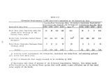
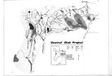
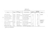
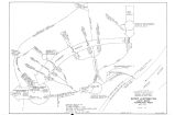
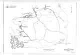
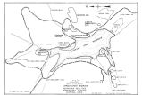
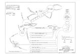
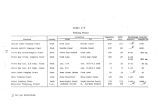
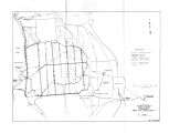
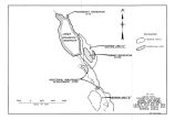
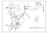
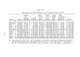
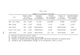
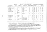
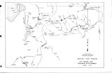
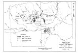
Show Beer Creek Pumping Plant would be located on Beer Creek about 12 miles west of Spanish Fork. Access to and construction materials for the pumping plant would be the same as those described above for the dike. Beer Creek Diversion Dam would divert water from the natural channel of Beer Creek about 3 miles north of Payson into the Beer Creek Canal. The canal would traverse a relatively flat area formerly occupied by Utah Lake in a westerly direction, where it would intercept the improved Spring Creek Channel, a tributary of Beer Creek Canal. It would then traverse northwesterly, where it would end in the natural channel of Beer Creek, approximately 7.5 miles west of Spanish Fork. During the spring runoff high flows of Beer Creek and Spring Creek would be diverted into Utah Lake. Beer Creek Canal would also convey return flow water to these lands for irrigation during the irrigation season. ( 12) Mosida Canal and Pumping Plants Mosida Canal would be located on gently rolling land in west- central Utah County along the northwest side of Goshen Valley and the southwest side of Utah Lake. Water would be lifted from Utah Lake into the canal through a 0.3- mile- long discharge line by the Mosida Lower Pumping Plant. The Mosida Relift Pumping Plant would lift water from the canal to a higher section of the canal through a 0.3- mile- long discharge line for irrigation of lands in the southern portion of the Mosida area. ( Physical data on the pumping plants are given in Table A- 6.) The gently sloping land would facilitate the canal construction and restoration of the adjoining area. Access would be provided by existing roads along the alinement. Construction aggregate is available from local commercial sources. ( 13) Subsurface Drainage Corrective measures for subsurface drainage deficiencies were planned as a part of the Bonneville Unit development. The corrective program as now formulated is provisional. Much of the drainage system cannot be finally designed until the Bonneville Unit irrigation system has been in operation and exact locations of the drainage problems have become apparent. The provisional layout of the subsurface system would provide for about 157 miles of closed drains, 68 miles of open drains, 12 miles of outlet collector drains, and 8 miles of natural channel improvements. The layout would include Beer Creek 88 |


