| OCR Text |
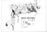
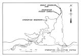
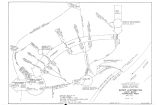
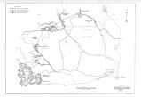
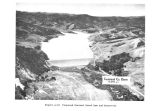
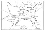
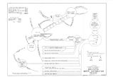
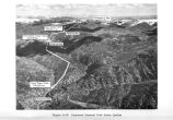
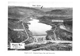
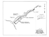
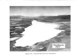
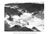
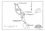
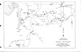
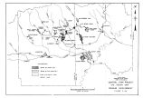
Show Rockfill would likely be obtained by quarrying from large massive layers of quartzite located on the east shore near the upstream end of the reservoir ( Fig. A- 9). The talus slopes on the east side of the reservoir, a short distance upstream from the damsite, and rock formations located in the bottom of the reservoir basin would be alternative sources of rockfill. Aggregate to be used in the asphaltic membrane would probably be obtained from deposits within Lower Stillwater Reservoir Basin, approximately 8.5 miles downstream from Upper Stillwater Damsite. The contractor's camp would be located below the damsite. The Forest Service and the Bureau of Reclamation are studying an alternative site for an administration camp which would be located near Miner's Gulch about midway between Upper and Lower Stillwater damsites. Prime recreational facilities would be constructed immediately below Upper Stillwater Dam. The Yellow Pine Recreation Complex would probably be developed later about 5 miles downstream from Upper Stillwater Dam. Docs Diversion Structure and Feeder Pipeline Docs Diversion Structure on the South Fork of Rock Creek would divert water into Docs Feeder Pipeline for conveyance to Upper Stillwater Reservoir. The diversion site is located about 11/ 4 miles upstream from its confluence with Rock Creek. The site would be reached by the same route as that for Upper Stillwater damsite, with a short reach of Forest Service road up the South Fork of Rock Creek. The land is in Ashley National Forest and is being used for multiple purposes. The diversion structure would consist of a reinforced concrete drop inlet structure leading to the feeder line. Flows in excess of those required for diversion would pass over the inlet grating which would be located at streambed elevation. The site is presently reached by a foot trail approximately 500 feet long through thick aspen and pine growth. A short construction road to the site would be necessary from the Forest Service Blind Spring Road up the South Fork. Electric power for construction and operation would be delivered over a 3/ 4- mile- long branch from the transmission line to Upper Stillwater Dam. Docs Feeder Pipeline would run northerly along the west side of Rock Creek Canyon from the diversion site to Upper 44 |


