| OCR Text |
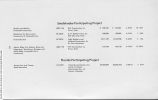
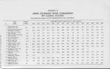
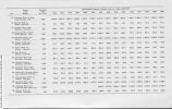
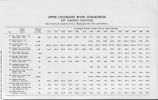
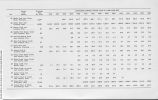
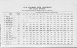
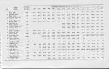
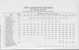
Show Through the cooperation of our four States and the U.S. Geological Survey, the office now has an up-to-date set of topographic quadrangle maps of the Upper Colorado River Basin. Stream Flow Gaging Stations With the cooperation of the Surface Water Branch of the Geological Survey we are collecting and organizing all data, such as, runoff records, station descriptions, locations, drainage areas, financing, suitability for correlation, etc. for gaging stations in the Colorado River Basin. Maps of each State are being prepared showing the location of these stations. All stations will be analyzed and reviewed with reference to their adequacy and purpose. This is being done as one of the preliminary steps leading to comprehensive hydrological studies and consumptive use of water studies above every major gaging station in the basin in order that eventually we can know intimately the behavior and characteristics of every stream and its watershed before attacking directly the major problems, such as, stream flow routing, operation of the Storage Units, and other aspects of river operation studies. We have cooperated with the Soil Conservation Service by furnishing a list of gaging stations for which it is believed it would be advantageous to obtain forecasts of runoff. The Soil Conservation Service has furnished a map of the Colorado River Basin on which is indicated all snow courses, aerial markers, etc. installed by the Service in its snow survey program. Participating Projects Central Utah Project Several special problems have been encountered in the process of planning the Congressionally authorized initial phase of the Central Utah Project. In an attempt to resolve these problems a Duchesne River Area Study Committee was formed. Serving on this committee are the following representatives: Upper Colorado River Commission Paul A. Rechard, Chairman Bureau of Indian Affairs James W. Chamberlin Frederic H. Varnum Ute Indian Tribe R. 0. Curry Elbert L. Decker 24 |


