OCR Text |
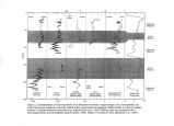
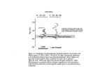
Show Marith C. Reheis U. S. Geological Survey MS- 980, Federal Center, Box 25046 Lakewood, CO 80225 PLIOCENE TO MID- PLEISTOCENE LAKES IN WESTERN NEVADA: AGE AND CONNECTIONS During the Pliocene to middle Pleistocene, pluvial lakes in western Nevada repeatedly rose to levels much higher than those of the well- documented later Pleistocene pluvial lakes, and some presently isolated basins were connected ( Reheis and Morrison, 1997). Sedimentologic, geomorphic, and chronologic evidence indicates that Lakes Lahontan and Columbus- Rennie were as much as 70 m higher in the early- middle Pleistocene than during the Eetza- ( late- middle Pleistocene) and Sehoo ( late Pleistocene) high stands ( fig. 1). At this level, Lake Lahontan would submerge present- day Reno, Carson City, and Battle Mountain, and would flood other basins. The Walker Lake sub- basin of Lake Lahontan held three or four deep lakes during the early Pleistocene that were 15- 25 m above the Sehoo high stand. High beach deposits suggest that Lake Russell previously overflowed to the Walker River. Deposits of Pliocene lakes suggest connections among proto- Lakes Lahontan, Columbus- Rennie, Clayton, and possibly Tonopah ( fig. 1). Reconstructing these lake levels has important implications for paleoclimate, tectonics, drainage evolution, and migration of aquatic species in the Great Basin. EVIDENCE FOR OLD PLUVIAL LAKES IN THE LAHONTAN BASIN The Walker Lake basin ( area of WL, fig. 1) contains much of the stratigraphic evidence for early and middle Pleistocene lakes with high shorelines in the Lahontan basin. Three or four highstands are recorded by lacustrine and deltaic deposits in the Walker Lake basin during the early Pleistocene ( fig. 2); during this time, Walker Lake may not have been connected to the northern Lahontan basins. The three oldest lake units have reversed magnetic polarity and thus were deposited within the Matuyama Chron ( 2.6- 0.8 Ma). Of these, the middle unit contains horse and mammoth bones that provide a maximum age of 1.4 Ma; this unit also contains bones of Lahontan cutthroat trout ( R. Miller, written commun., 1996) that require a drainage connection between the Walker Lake basin and the northern basins at this or some previous time. The youngest of the reversed units contains a normal- polarity interval equivalent to the ~ 1- Ma Jaramiilo Subchron and locally also contains ~ 1- Ma Glass Mountain tephra. Lake deposits at two other sites contain tephra layers which, based on chemical composition and paleomagnetic data, could be either the 0.76- Ma Bishop ash or a ~ 1- Ma Glass Mountain tephra. Two high stands of middle Pleistocene age are recorded throughout the Lahontan basin by beach deposits ( fig. 2). North of the Walker Lake sub- basin, these sites consist of deltaic(?) deposits and of beach gravel lagged on bedrock slopes. One unit, which unconformably overlies older lake units in the Walker Lake basin, rises to a shoreline elevation of ~ 1400 m and is thought to be correlative to the ~ 0.7- 0.6- Ma Rye Patch Alloformation dated by ash beds along the Humboldt River ( Morrison, 1991). This age and the very high lake level represented by the gravels suggests a correlation to marine- oxygen- isotope stage 16 (~ 0.63 Ma), which was one of the larger deviations toward glacial ( pluvial) conditions. Shoreline deposits of a younger unit are inset into older units below an altitude of 1370 m and at one site have normal polarity; possibly this unit is correlative to oxygen- isotope stage 12 (- 0.43 Ma). The implications of a 1400- m shoreline are staggering ( fig. 1): such a lake would inundate Granite Springs Valley, would back up the Truckee and Carson Rivers to submerge all or part of |