OCR Text |
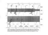
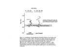
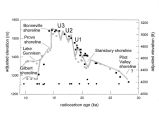
Show when Lake Lahontan was relatively shallow. They noted that this was consistent with the conclusions of Negrini and Davis ( 1992) for Lake Chewaucan at the time the Wono fell. In the Chewaucan PSV record, the Wono tephra lies within a very distinct set of waveforms ( Figure 2) which follow the Mono Lake Geomagnetic Excursion ( Lund et al., 1988). Thus, in principle, all pluvial lake sediments in western North America with reliable PSV records and lake level proxy data could be compared at 27,300 ± 300 14C yr B. P. to perhaps find the location of the migrating jet stream storm track. In addition, comparisons could be made with marine records from offshore North America to tie in pluvial lake levels with marine global climate proxies. In this respect, PSV records have two distinct advantages over tephra layers; their range of applicability is much larger and they cover a large interval of time rather than a single instant. A lake level history of the Chewaucan/ Fort Rock/ Alkali Lake area has been developed for the late Pleistocene by Friedel ( 1993) based in part on earlier works by Bedwell ( 1973), Allison ( 1979), ( 1982), Forbes ( 1973), Davis ( 1985), and Negrini and Davis ( 1992). In contrast to the previously described studies of lake bottom sediments which could only estimate relative lake level, Friedel's lake level history was based primarily on dated shoreline features. The resultant lake level history, though not nearly as well constrained as its Lahontan and Bonneville counterparts, provides a good first order agreement with the histories of those lakes. In addition, this model suggests that the Oregon lakes began to fall as much as 1,500 years before Lakes Lahontan and Bonneville reached their maximum levels, though the initial rate of decrease was low enough so that the Oregon lakes completed their recession at approximately the same time as their southern counterparts. Holocene lake level histories of the northwestern Great Basin are sparsely constrained but, nevertheless, appear to converge on a model consistent with ubiquitous shallow lakes and marshes in the early and late Holocene separated in time by a middle Holocene (- 8,000 - 4,500 14C yr B. P.) lowstand ( see reviews in Grayson, 1993; McDowell and Dugas, 1993; Freidel, 1993). In the northern part of the Alkali Lake basin, in the Fort Rock basin, and in the Lake Chewaucan basin small, shallow lakes and or marshes were inferred to have been present for much of the interval from - 11,500- 7,000 14C yr B. P. based on geographical distributions of archeological sites and faunal contents therein ( Bedwell, 1973; Willig, 1988; Oetting, 1988). These lake level histories are remarkably consistent with the age of dated shorelines from the nearby Harney/ Malheur lake system ( Gehr and Newman, 1978; Gehr, 1980; Grayson, 1993; McDowell and Dugas, 1993). Following a three thousand year or so interval of time in the middle Holocene characterized by a dearth of archeological sites in these basins and increased eolian activity, several archeological sites emerge in the late Holocene along a slightly elevated Chewaucan shoreline ( McDowell and Dugas, 1993; and references therein). These results are consistent with the lake level history of the Diamond Pond volcanic crater as deduced by Wigand ( 1987) from pollen in the sediments of this small lake. Notably, from the bottom of the record (- 6,000 14C yr B. P.) to 4,500 14C yr B. P., aquatic pollen was absent indicating that the water table was very low during this time. The longest records from the northwestern Great Basin come from the Klamath Lake area where cores were taken from several locations ( Adam, 1993). The longest of these records, from Tule Lake, extends well into the Pliocene as indicated by tephrochronology and magnetic reversal stratigraphy. These cores contain responsive records of major global climate events based on pollen, diatoms, ostracodes, lithostratigraphy, geochemistry, and sediment magnetism ( e. g., Adam et al, 1989; Rosenbaum et al., 1996). The Klamath area coring program is a good model for similar programs in the rest of the northwestern Great Basin which could be the flag bearers for the next fifty years of climate studies in this important region. The bottom sediments of these pluvial lakes hold sensitive repositories of climate change in their biota, lithology, chemistry, and magnetism. Recent advances 1) in age control including the direct TL and Ar- Ar dating of tephra ( Berger, 1991; Chesner, 1991); 2) in correlation with other basins and marine sediments |