| Title |
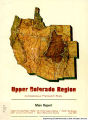
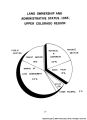
Upper Colorado Region Comprehensive Framework study : Main report. |
| Creator |
Upper Colorado Region State-Federal Inter-agency Group |
| Subject |
Water resources development; Watershed management; Flood control; Irrigation |
| OCR Text |
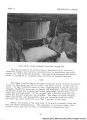
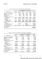
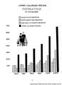
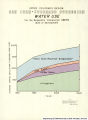
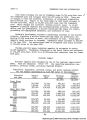
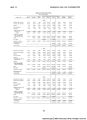
Show This report presents a framework program for the development and management of the water and related land resources of the Upper Colorado Region. |
| Publisher |
Upper Colorado Region State-Federal Inter-agency Group : Pacific Southwest Inter-agency Committee, Water Resources Council [1971]Upper Colorado Region State-Federal Inter-agency Group : Upper Colorado Region State-Federal Inter-agency Group : Pacific Southwest Inter-agency Committee, Water Resources Council [1971] |
| Contributors |
Gessel, Clyde D.; Hagen, Robert H. |
| Date |
1971-06 |
| Type |
Text |
| Format |
application/pdf |
| Digitization Specifications |
Digital images were scanned by Backstage Library Works Inc. Bitonal materials were scanned at 400ppi using a Panasonic KV-S2065W sheetfed scanner. Grayscale materials were scanned at 400ppi using an Image Access WideTEK flatbed scanner. All files were saved as TIFF and converted to JPEG for Web presentation. PDF files were also generated from the TIFF files. |
| Language |
eng |
| Rights Management |
Digital image copyright 2004, University of Utah. All rights reserved. |
| Contributing Institution |
S.J. Quinney Law Library, University of Utah. 332 South 1400 East, Salt Lake City, UT 84112-0730 |
| Source Physical Dimensions |
26cm x 20cm |
| Scanning Technician |
Backstage Library Works 1180 S. 800 E. Orem, UT 84097 |
| Call Number |
KF5582.C6 A8 |
| ARK |
ark:/87278/s6q81cd3 |
| Setname |
wwdl_documents |
| ID |
1133059 |
| Reference URL |
https://collections.lib.utah.edu/ark:/87278/s6q81cd3 |
| Title |
UUM_UpperColoMain_page_014 |
| OCR Text |
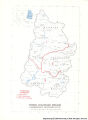
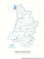
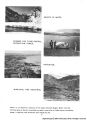
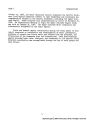
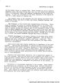
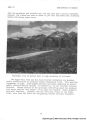
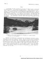
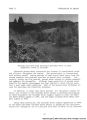
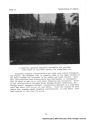
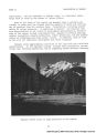
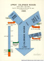
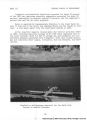
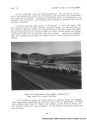
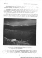
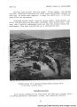
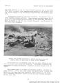
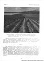
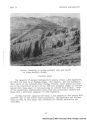
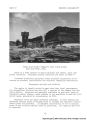
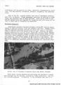
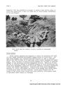
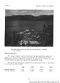
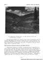
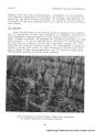
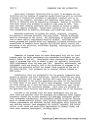
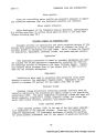
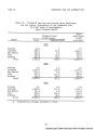
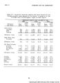
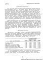
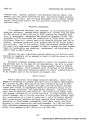
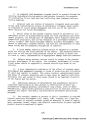
Show PART II DESCRIPTION OF REGION feet the mountains and plateaus are, for the most part, heavily forested; however, the timberline ends at about 11,500 feet and above that elevation alpine and barren areas occur. Panoramic view of Kebler Pass in high mountains of Colorado. The Upper Main Stem and San Juan-Colorado Subregions are predomi- nantly characterized by severely eroded sedimentary rocks. This peculiar topography of high, flat-topped plateaus and mesas separated by narrow, nearly vertical-walled canyons is referred to as the Colorado Plateaus Province. Stream erosion as the principal weathering agent has produced cuts where -various rock layers of all ages are exposed. These dramatic erosional features, together with the brilliant colors of the forma- tions, have been the basis for designating several national monuments. |
| Format |
application/pdf |
| Resource Identifier |
030_UUM_UpperColoMain_page_014.jpg |
| Source |
Original document: Upper Colorado Region Comprehensive Framework Study: Main Report |
| Setname |
wwdl_documents |
| ID |
1132952 |
| Reference URL |
https://collections.lib.utah.edu/ark:/87278/s6q81cd3/1132952 |