| OCR Text |
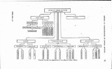
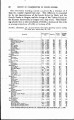
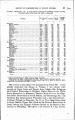
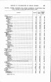
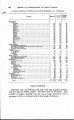
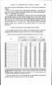
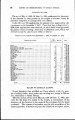
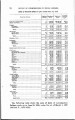
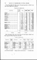
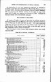
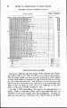
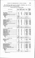
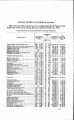
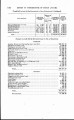
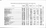
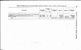
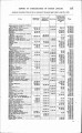
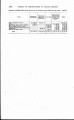
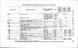
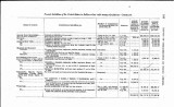
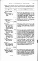
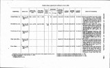
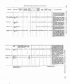
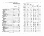
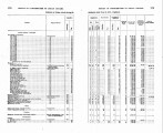
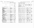
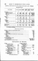
Show On September 27, 1907, the department approved an application to survey a spur line across the Shoshoni Reservation from a point on its main line to the mine of the Hudson Coal and Grain Company. The map showing -the definite location of this right of way, a dis-tance of 1.77 miles, was approved on October 14, 1907. Damages in the sum of $215 have been assessed and paid. RAILROADS IN OKLAHOMA. All grants of rights of way and grounds for railway purposes involving Indian lands in Oklahoma are made in accordance with the act of February 28, 1902 (32 Stat. L., 43). The maps submitted under the provisions of this act are not subject to the approval of the Secretary of the Interior, but are filed in this o5ce as a part of the permanent records of the Government. The following is a list of maps filed during the fiscal year ended June 30,1908 : Maps flZed of railroads Gb Oklahoma. Name of company. grounds. Atchison. Topeka and Banla Pe Rallmnd. Ad.lilional ground* as Ardmorr tlkls ......... A d ~ l l l o ~ I~IIu,,Ul ~I~~J... ......................... Alltlllll,nal r r ,>unds~ltl umar. "kla ........... Addr~ioltxle r.,u~tdcarR 'ynaew~udO. kia As1 l i l i u n ~ l ~mu n ; l ~AnnIlm ore. Okla.. 9. RC 5.3 Addl l rol lxlur~dl ldrin err:.:-and 31, T. 3N.. R. I E 9. f4 Ad~l l l ,l r . r i~nul l l l r I " ................................................................................ ......... 1.6 .6 so. a 36.3 I)". ........................................................................... M i u r l Ok18holu8 dnd Gulf Redroad: 36.3 .......................... .............................. I4 1 ............ Cod rps~rt rsrk, lrvooald nnnc ........................................... ............ |