OCR Text |
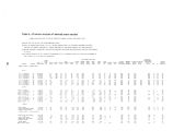
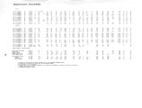
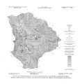
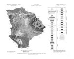
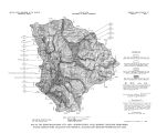
Show given in table 1. This is a composite section and nowhere in the area are all the formations present. Plate 2 is a geologic map showing the areal distribution of the various rock units. The rocks in both the Wasatch Range and the Uinta Mountains have been subjected to considerable deformation and are greatly fractured, faulted, and folded. The most prominent displacement in the area is the Charleston thrust fault, which crosses the south end of Heber Valley. Several smaller thrust faults have been mapped, and high- angle faults of small displacement are numerous. Joints and fractures are ubiquitous, and solution openings are common in the carbonate rocks. These openings and the faults play a major role in controlling the movement of ground water in the area. Small folds are abundantly present, but they exert little influence on ground- water movement Water moves through the rocks along the abundant fractures, solution openings, and fault planes, and thus any formation may be, at least locally, water bearing. In his report on the Park City Mining District, Boutwell ( 1912, p. 24) observed that the water in the mines came principally from " the red shale and massive quartzite" ( Woodside Formation and Weber Quartzite). Officials of the United Park City Mining Co. agree that most of the water in that company's workings appears in tunnels that penetrate the Weber Quartzite ( J. Ivers, Jr., oral commun., 1967). In 1967, the few wells in the project area that were finished in the consolidated rocks derived their water from only 11 of the more than 30 geologic units under the area. The producing formations were the Quaternary tufa deposits, the Tertiary volcanic rocks, the Knight Conglomerate, the Preuss Sandstone, the Twin Creek Limestone, the Nugget Sandstone, the Chinle Formation, the Ankareh Formation, theThaynes Formation, the Oquirrh Formation, and the Weber Quartzite. Other units, especially the carbonate rocks of Pennsylvanian, Mississippian, and Devonian age, yield water to springs in the area, and Feltis ( 1966, p. 14- 17) states that in the Uinta Basin, southeast of the study area, some water is obtained from the Park City Formation of Permian age and from the Uinta Formation of Tertiary age. More wells in the study area obtain water from the Tertiary volcanic rocks than from any of the other formations, probably because the volcanic rocks are the shallowest consolidated rocks in the areas where most of the bedrock wells are located. Aquifer characteristics In a broad way, for the purpose of evaluating areal movement of ground water, the highly fractured rocks of the Wasatch Range can be regarded as a single homogeneous aquifer, and the same is probably true of the rocks in the Uinta Mountains. On the small scale involved in selecting sites for the development of water supplies, however, the aquifers are grossly heterogeneous. Information from drillers' tests of wells finished in the consolidated rocks shows that the development of supplies of water sufficient for irrigation, industrial needs, or public supplies from the consolidated rocks depends upon the wells intersecting water- bearing fractures. Even in a fracture system that is properly described as " closely spaced," however, the distance between adjacent fractures may be very large compared to the diameter of a well. Hence, the construction of wells to intercept water moving through fractured rocks tends to be a " hit- or- miss" affair. The large discharge of water from mine tunnels near Park City should not be taken as an indication of the potential yield of wells. Each tunnel drains many miles of workings, whereas a well usually drains a relatively small area. Small supplies, adequate for domestic use in single- family dwellings, can probably be obtained from several of the consolidated rock units. Drillers' reports of a few wells ( table 3) include the results of pumping tests, generally of only a few hours duration. The test results were evaluated by the method of Theis and others ( 1963) to derive the values of aquifer transmissivity included in table 1. 18 |