OCR Text |
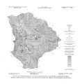
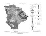
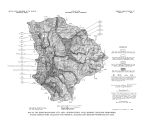
Show Unconsolidated deposits cover only about 21 square miles of Parleys Park along Silver and East Canyon Creeks and in the flats northwest of Quarry Mountain ( pi. 2); the rest of the park is underlain by consolidated rocks, principally the Tertiary volcanic rocks and the Knight Conglomerate. Little information is available about the thickness of the unconsolidated deposits. The contact between the unconsolidated material and the underlying volcanic rocks or Knight Conglomerate is difficult to recognize in boreholes, and drillers often fail to recognize the contact. The differences in density between the unconsolidated deposits and the underlying material are too small to give conclusive results by gravity methods. The best information available suggests a maximum thickness of about 100 feet and an average thickness of about 60 feet. The unconsolidated deposits in Parleys Park, as in Heber Valley and Rhodes Valley, consist of a poorly sorted mixture of material ranging in size from clay to cobbles. There appear to be no well- defined beds of material of very high or very low permeability, and no indications of the existence of artesian conditions. The unconsolidated deposits are saturated to within a few feet of the land surface with unconfined ground water. There are very few wells in the unconsolidated deposits of Parleys Park to provide a basis for estimating the transmissivity and specific yield of the aquifer. The specific capacity of one well is reported as 20 gpm per foot of drawdown; such a specific capacity suggests an aquifer transmissivity of about 4,670 fts/ d/ ft. The aquifer at the well location is about 100 feet thick, giving an estimated hydraulic conductivity of about 50 ft3/ d/ ft2- about the same as the value derived for similar material in Heber Valley. The few drillers' logs available are not suitable for calculating specific yield by the method used in Heber Valley and Rhodes Valley; however, an estimate of 15 percent, based on the values derived in the other areas, is probably in the right range. Recharge to the unconsolidated deposits in Parleys Park comes primarily from the direct infiltration of precipitation on the park and runoff from the surrounding mountains, and secondarily from subsurface inflow through the consolidated rocks. Available data on the annual range of water- level fluctuations are too scanty to permit a direct estimate of the average annual recharge. The probable minimum recharge is indicated by the estimated evapotranspiration ( see below). The inferred direction of ground- water movement in Parleys Park is shown in figure 17. Water in the eastern arm of the park moves toward Silver Creek and down the valley. In the western arm of the park, ground water moves generally northward toward East Canyon Creek. Each of the small tributaries of East Canyon Creek that crosses the park is a gaining stream, however, and locally ground water moves toward each of these streams. The water- level fluctuations in well ( D- 1- 4) 31bdb- 1 were observed from 1936 to 1948; the well was destroyed in 1948. Well ( D- 1- 4) 31adb- 1 was monitered by an automatic water- level recorder that was installed in October 1966 and operated intermittently through 1968. Graphs of water levels in these wells are shown in figure 18. The short- term record of well ( D- l- 4) 31adb- 1 shows annual fluctuations of more than 17 feet, but the longer record of well ( D- l- 4) 31bdb- 1 shows no substantial long- term change in the position of the water table. Any calculation of the amount of water available from storage in the unconsolidated deposits of Parleys Park can be only a rough estimate. The maximum depth to water recorded in well ( Q- 1- 4) 31adb- 1 was nearly 20 feet; if the average thickness of the unconsolidated deposits is 60 feet, the average saturated thickness ( when the water table is lowest) is about 40 feet. If the 42 |