OCR Text |
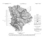
Show the Uinta Mountains, Beaver Creek, drains the southwestern slopes of the range. Beaver Creek parallels the course of the Provo River for many miles, then turns northward through Rhodes Valley and joins the Weber River near Peoa. Two major tributaries enter the Weber River from the southwest and drain parts of the study area. Silver Creek heads in the Wasatch Range southwest of Park City and drains part of Parleys Park; Silver Creek joins the river at Wanship ( fig. 1). East Canyon Creek drains most of Parleys Park and flows generally northwestward out of the study area and joins the Weber River many miles downstream. Several small reservoirs near the head of the main stem of the Weber River and near the head of South Fork and one reservoir on Smith and Morehouse Creek have a combined regulated capacity of about 3,400 acre- feet. Wanship Dam, near the north boundary of the study area, impounds water in Rockport Reservoir, which has an active capacity of about 60,900 acre- feet. Water is diverted from the Weber River just upstream from Oakley into the Weber- Provo Canal, which carries the water out of the basin to the Provo River. Some water is also diverted into the Weber- Provo Canal from Beaver Creek, but no records are kept of the diversions from Beaver Creek. Water for irrigation in the southern part of Rhodes Valley is diverted into the Weber River basin from the Provo River ( South Kamas and Washington Canal). No other water is diverted into the basin unless the water of Shingle Creek is regarded as such a diversion. Early physiographic studies of the region show Shingle Creek as the principal fork of Beaver Creek ( Atwood, 1909, fig. 8), and Shingle Creek is shown on most maps as the upper part of the main stem of Beaver Creek. The divide between Shingle Creek and the North Fork Provo River is very low, however, and water from Shingle Creek is easily diverted into North Fork. Such diversions have been alternately made and unmade so many times that there is now considerable uncertainity concerning to which drainage the stream naturally belongs. In most recent reports of surface- water discharge in Utah ( U. S. Geol. Survey, 1961- 68), Shingle Creek is considered part of the Provo River drainage system, although nearly all the flow goes into Beaver Creek. Discharge The Weber River Commissioner's office has operated a gaging station on the Weber River just downstream from Wanship Dam since the dam was completed in 1957 ( see graph, fig. 6). The average discharge of the Weber River at this station for 10 years of record ( through water year 1967) was about 110,000 acre- feet per year. The discharge measured at this site does not include the diversions through the Weber- Provo Canal, which have averaged about 50,600 acre- feet per year for the same period. If the diversions to the canal are added to the discharge measured below Wanship Dam, the total outflow from the Weber River basin above Wanship Dam averages about 161,000 acre- feet per year. At present ( 1968) the U. S. Geological Survey operates four gaging stations on the Weber River and its tributaries ( counting Shingle Creek) above Wanship Dam. The periods of record and average discharges for these stations, the station below Wanship Dam, and three other stations on tributaries of the Weber River that drain the Parleys Park area are tabulated on page 16. The average annual diversion by the Weber- Provo Canal since its completion in 1931 is less than the average for the 10- year period 1957- 67; the long- term average is 32,900 acre- feet per year. The long- term average discharge from the canal to the Provo River is only 31,300 acre- feet 15 |