OCR Text |
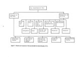
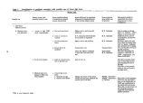
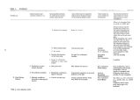
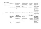
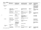
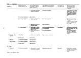
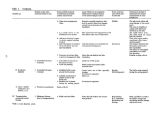
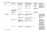
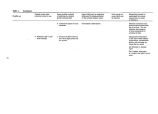
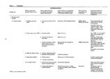
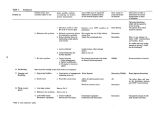
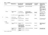
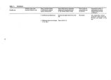
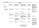
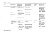
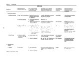
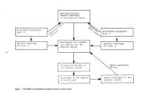
Show Hydrologic System The hydrologic system, as depicted in Figure 5, was divided into three areas, the watershed, the near shore, and the lake. The lake watershed. The Great Salt Lake drainage area or watershed is composed of major drainages, the Bear, Weber, and Jordan River basins, and a number of minor drainage basins. Components of the Great Salt Lake watershed systems have been the subject of various studies due to the importance of this resource in Utah's water development. The Utah Water Research Laboratory and the Utah Division of Water Resources have performed a series of water budget studies of the Bear, Weber, and Upper Jordan drainage areas ( Hyatt et al., 1969; Haws et al., 1970; and Haws and Hughes, 1973). Simulation model studies of the hydrology and salinity within the Bear River basin were performed by Hill et al. ( 1970 and 1973). A model study of the Upper Jordan River drainage was carried out by Wang et al. ( 1973). A 1974 study by the Utah Division of Water Resources estimated the effect of different levels of upstream water development on future lake stages. Under studies at the Utah Water Research Laboratory, the high resolution QUAL model ( Texas Water Development Board, 1970) and the intermediate resolution USU RM model ( Utah State University River Model - Grenney et al., 1974) were used to provide simulation models of waste load allocation on the Bear, Weber, and Jordan Rivers. These models cover the Weber- Ogden system from Park City and Kamas to Great Salt Lake, the Jordan River from the Jordan Narrows to Great Salt Lake, and the Bear River from the Utah- Idaho border to Great Salt Lake. Several studies of the smaller drainage areas of Great Salt Lake also have been performed. A water budget study of the Great Salt Lake Desert area, similar to the water budget analysis of the major rivers, was prepared by Foote et al. ( 1971). The water resources of Salt Lake County were discussed in Hely et al. ( 1971) and later simulated in a computer model ( Israelsen et al., 1973). Future water use in Utah Valley was modeled by Huntzinger ( 1971). A water resource allocation model of the entire State of Utah, including Great Salt Lake, has been developed at the Utah Water Research Laboratory ( Keith et al., 1973). Additional research needs which were identified for the watershed area were determining the effects the lake has on the climate within the Great Salt Lake drainage basin. Such studies should address the effects on precipitation and air temperature of inadvertent cloud seeding as storms pass over the lake. These research items are included in Table 9. The near shore area. From a hydrologic viewpoint the near shore area can be considered as a strip of land around the perimeter of Great Salt Lake which contains the marsh lands. The water requirements for waterfowl marsh lands in the vicinity of Great Salt Lake were studied under an extensive project which began in 1959 as a cooperative effort of the Utah State Division of Fish and Game, the Utah Water Research Laboratory, and the USU Cooperative Wildlife Unit. The investigation took place on the Howard Slough management area and the data gathered were used to develop a procedure for determining the monthly and seasonal water requirements for marsh lands. The results of the study are summarized by Christiansen and Low ( 1970). This report presents a method for calculating marsh land water requirements based on the salinity of flow, the evapotranspiration ( consumptive use) from the marsh land, and the precipitation on the marsh land. The study not only provided a means for estimating water requirements of marsh lands, but also through the development of the necessary background information and data, provided insight into the tolerance of marsh plants to salinity and the evaporation losses to be expected within marsh lands. The research needs for the near shore area are included in Table 9 and consist of accumulating information on the lake elevations which will cause flooding of the marsh lands, methods of equalizing the spring and summer inflows to the marsh lands, and the quantity and quality of groundwater inflow. The lake. Great Salt Lake itself is an important component of the Great Salt Lake system. The unique characteristics of the lake provide an unusual combination of resources which support a variety of social use activities. However, use of the lake can severely alter its characteristics as the construction of the railroad causeway has shown. The hydrologic processes within the boundaries of the lake determine its character under any degree of alteration imposed by man. Principal considerations of users of the lake resources regarding the hydrologic system are lake elevations and salinities to be expected in the future and how they would be affected by alterations of the present physical system. Both the lake level and salinity are affected by the inflow and outflow from the lake and the exchange between physical divisions of the lake; namely, the north arm, the south arm, and to a lesser degree Farmington Bay. The inflow and outflow of water and salt from a system constitute the water and salinity balances, respectively. Since water is the transport mechamism for salt, the two balances are closely tied. 38 |