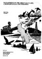
OCR Text |
Show recreational facilities, land access to island rookeries, and the precipitation of salt changing the characteristics of the brine. Although not of immediate concern, research should be conducted on the possibility of future extreme low lake levels. An additional consideration is the loss of salt from the system at such times due to sediments being deposited over a precipitated salt crust. A layer of material such as decaying algae could impair the redissolving of the salt crust as the lake rose and essentially remove the salt from the lake. The loss of salt from the lake in this manner has not been addressed but may represent a real concern. Consideration must be given to how the solution of either a high or low water elevation problem will affect the lake when a wet or dry cycle is reversed. This is possible when the response of the components of both the water and salinity balance can be predicted under varied hydrologic conditions. Mineral extraction is the main social use influenced by the lake salinity. However, the salinity of the lake also has an impact on recreation, the brine shrimp industry, and the ecosystem, but identifying these impacts represents research needs. The future salinity of the lake cannot be separated from the water balance. The annual inflow of total dissolved solids is small compared to the total load in the lake. Therefore, the surface and groundwater inflows combine with the precipitation to dilute the lake brines. Evaporation removes water from the lake and concentrates the brine. The salt balance for the north and south arms of the lake thus is principally a function of the exchange of brines through the railroad causeway, the vertical mixing of salt in the south arm, and the exchange of salt with the lake bed. The chemical makeup of salinity inflow to Great Salt Lake has been investigated mainly by the USGS and Utah Geological and Mineral Survey ( UGMS). Hahl and Mitchell ( 1963) present a compilation of data collected from July 1959 through June 1962 to aid in the definition of the chemical composition of streams, drains, and springs discharging into Great Salt Lake and, additionally, to define the chemical composition of the lake brine. Hahl and Langford ( 1964) continued the study and report on conclusions drawn from the above data. During the 1964 water year more detailed data were obtained on surface inflow at sites closer to the lake shore. Hahl ( 1968) used these data to estimate the salt inflow at the lake shore for water years 1960, 1961, and 1964. The data for 1960 and 1961 were collected during low inflow and low lake stage years. The fact that data for high flow years were not included may affect the estimate of salt inflow to the lake which Hahl obtained. The present USGS basic data gathering project includes monitoring the quality of surface inflows. Determining the salinity of groundwater inflows represents a research need. Mineral extraction accounts for the major output of salt from the lake. Since a royalty must be paid on salt extracted from the lake the yearly output is well documented ( Searle ct al., 1976). A small amount of salt leaves the lake each year by wind transport but the amount is apparently very small. Prior to the construction of the railroad causeway the concentration of the brine in the lake was directly related to the lake stage ( Glassett, 1974). Under present conditions ( Figure 6), the north arm contains a well mixed concentrated brine. South of the causeway the lake is vertically stratified with a relatively dilute brine overlying a more concentrated brine. The lower brine represents about 10 percent of the total volume of the south arm. No data are available to establish if the lake was stratified before the causeway construction. SOUTH ARM SAMPLING POINTS: o Antelope - Carrington @ 3- 16- 71 a Antelope- Carrington ( 4) 3- 16- 71 ( shallow brine only) NORTH ARM SAMPLING POINTS: A Little Volley Harbor - Gunnison Line @ 3- 29- 71 "¥- T& 10 230 250 270 290 310 320 TDS CONCENTRATION ( g/ l) Figure 6. Typical variation of total dissolved solids with depth for the south and north arm brines. The Utah Geological and Mineral Survey ( UGMS) has had, since 1966, an ongoing program of sampling the brine and determining its ionic composition. The UGMS sampled on an irregular basis until 1973 when a quarterly sampling program was instituted. Presently when a station is sampled, samples are taken at the surface and at each 5 foot interval to the bottom. A complete set of data giving the total dissolved solids concentration on an ionic composition basis is 42 |