Pahvant Butte

Update Item Information
Title Terraces Scrapbook
Identifier terraces.xml
Subject Terraces (Geology)--Utah; Bonneville, Lake; Mountains--Utah; Rock formations
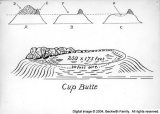
Description Scrapbook by Frank A. Beckwith. A set of photographs of various terraces in western Utah, with descriptive captions describing the setting and the occasions on which photos were taken. Many of these terraces were old shorelines of Lake Bonneville. Includes a road map with terraces drawn in. Terraces described include those at Leamington, Tatow Knob (House Range), Reservoir Butte, Cup Butte, Quartzite Butte, and others
Spatial Coverage Millard County (Utah); Bonneville, Lake
Creator Beckwith, Frank Asahel, 1876-1951
Publisher Hosted by J. Willard Marriott Library, University of Utah
Type Text
Format application/pdf
Source Terraces scrapbook
Language eng
Relation Frank Asahel Beckwith Collection
Rights Management Digital image copyright 2003, Beckwith Family. All rights reserved
Holding Institution Delta City Library
Source Material Scrapbook
Source Physical Dimensions 26cm x 33cm
ARK ark:/87278/s6jt2kk5
Setname dc_bpc
ID 126245
Reference URL https://collections.lib.utah.edu/ark:/87278/s6jt2kk5

Page Metadata

Title Pahvant Butte
Identifier 058T
Subject Terraces; Mountains; Rock formations; Lakes and pondss
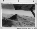
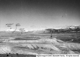
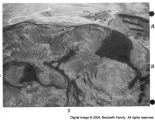
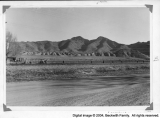
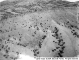
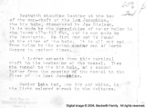
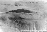
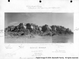
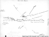
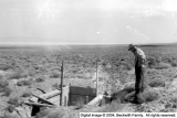
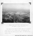
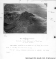
Description See the "sea terrace" cut on the north face. The Bonneville level is very plain. Pahvant Butte is 19 miles south of Delta. Sea Cliffs on the forward end, where the waves cut sharp notches out of the lava. A promoter had a windmill on the cinder cone, with a huge fan to generate electricity. Reinforced cement posts are all that remain now of mill and generator.
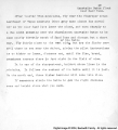
OCR Text w Pahvant Butte Goshort Tt takes ot the current on this trin to Fahvant Sutte if withed or mk that separate trip from Delta only about twenty miles excellent photos from the air Fly clove and yon will ruins of the Twind mill erected there to make electric A1 you iill see now are the cement pos once sup to ortinecirenlar track which presented the huge fun el the winds andgenerator in the center Fly south of Pahvant Butte some distance and high and you Will get that it is really two craters one large very old the one which Gilbert writes about within more rec Go afoot and see the sea terrace cut on the north face practically coincident with the Provo level The BonnevlevYash from avove has oblitero1 is very nlain and unmistakable ated the sharpness of the Provo level but fromdistance of oopioc 0w can sately
Spatial Coverage Millard County (Utah)
Contributors Burraston, Leo Roy, 1918-1974
Type Image
Format application/pdf
Format Creation image/tiff
Coverage Utah
Source Material Terraces Scrapbook
Archival Resolution Archival TIFF: 3000 x 4600
Low Resolution JPEG: 800 x 600
Bit Depth 8-bit
Scanning Device Creo-Scitex Eversmart Jazz+ flatbed scanner
Setname dc_bpc
ID 125439
Reference URL https://collections.lib.utah.edu/ark:/87278/s6jt2kk5/125439